
Photo Gallery of Northwestern Sumatra: 22 January 2005:
travelling from host home in Banda Aceh to survey site in Lho Nga
|
|||||||||
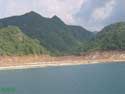
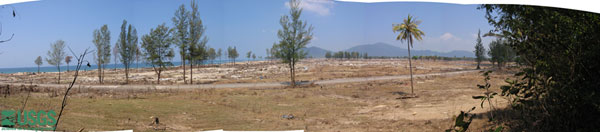 Panoramic photo in Lho Nga |
|||||||||
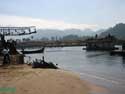
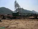
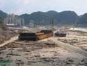
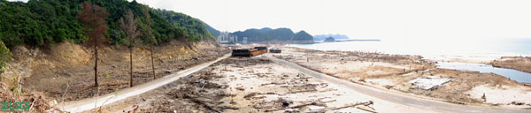 The powerful tsunami waves snapped off trees, swept buildings from their foundations, and stranded the coal barge and tugboat shown in this photograph taken south of Lho Nga looking southward. The line along the cliff where thick green vegetation (above) meets brown rock and rubble (below) marks the elevation reached by tsunami waves here: 31 m (102 ft) above sea level. |
|||||||||
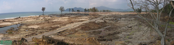 Panoramic photo south of Lho Nga looking northward, same coastal area where barge and tugboat were stranded (see panorama above). |
|||||||||
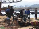
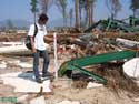
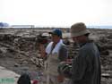
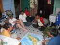 ITST scientists discussing survey plans |
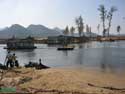 Bridge, destroyed by tsunami, makes river unpassable to cars and trucks. |
 Makeshift raft carries foot passengers across river. |
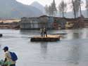
 temporary bridge being constructed across river |
||||||
 temporary bridge being constructed across river |
 Locals take motorcycle across river on raft. |
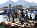 Locals take motorcycle across river on raft. |
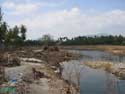
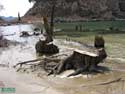
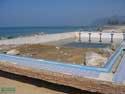 pool near coast filled with large rocks and sand from the tsunami |
||||||
 scour around pool and rock rubble carried inland by tsunami |
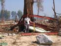 ITST member Raphael Paris stands near steel beams wrapped around tree |
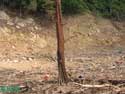
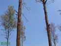 branches broken and bark scraped off tree up to height of tsunami |
 branches broken and bark scraped off tree up to height of tsunami |
||||||
 branches broken and bark scraped off tree up to height of tsunami |
 water tower knocked over by tsunami |
 steel beam bent by debris carried in the powerful waves that struck Lho Nga on Sumatra's west coast |
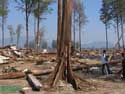
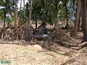
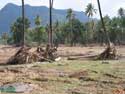
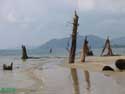
 trees snapped by tsunami |
||||||
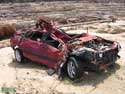 car damaged by debris and flowing tsunami |
 car and debris carried inland and piled up against trees |
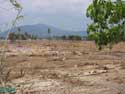
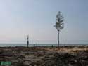
 landward limit of tsunami marked by lack of vegetation |
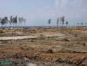
 tsunami flowed up river valley over 1.6 km from coast |
||||||
 tsunami flowed up river valley over 1.6 km from coast |
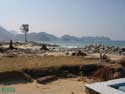
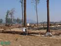
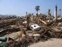
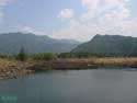
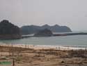
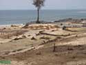
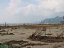
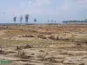 coastal plain inundated by tsunami |
 coastal plain inundated by tsunami |
 landward limit of tsunami marked by lack of vegetation |
||||||
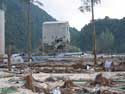
 buildings torn from foundations |
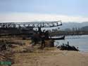
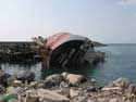
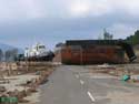
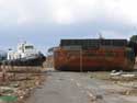
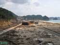 coal barge and tug carried onto land; tsunami runup reached 32 m here |
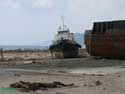
 closer view of barge and tugboat stranded by tsunami; tsunami runup reached 31 m here |
 ship overturned at cement factory harbor |
||||||
 closer view of barge and tugboat stranded by tsunami; tsunami runup reached 31 m here |
 trees snapped by tsunami |
 broken branches on tree help indicate tsunami height |
 ITST members Nishimura-san and Kamataki-san measuring water levels |
||||||
 broken branches and discolored vegetation from saltwater indicate tsunami height |
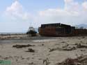 coal barge and tug carried onto land; tsunami runup reached 31 m here |
 coal barge and tug were held together by line |
 broken branches on tree near coast indicates water level close to the beach |
||||||
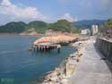
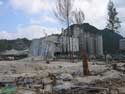 cement factory damaged by tsunami |
 cement factory damaged by tsunami |
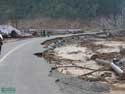 road partially destroyed by tsunami |
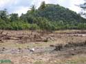
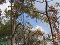
 trees submerged by sea suggest recent subsidence |
||||||
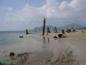 trees submerged by sea suggest recent subsidence |
 trees submerged by sea suggest recent subsidence |
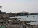 ship overturned at cement factory harbor |
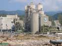 cement factory damaged by tsunami |
||||||
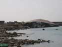 ship overturned at cement factory harbor |
 ship overturned at cement factory harbor |
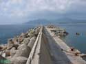 seawall protecting cement factory harbor |
 ship overturned at cement factory harbor |
||||||
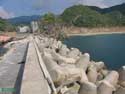 seawall protecting cement factory harbor |
 trim line along coast indicates tsunami height |
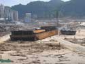
 view looking northward of stranded tugboat and barge |
 trees snapped by tsunami |
||||||
 view looking northward of stranded tugboat and barge |
Next photo set: January 23 > |
||||||||

 |
 |
 |
 |
|
 |
 |