


9 to 51 seconds (56K modem)

|
|
|
|
Image load time: 9 to 51 seconds (56K modem) |
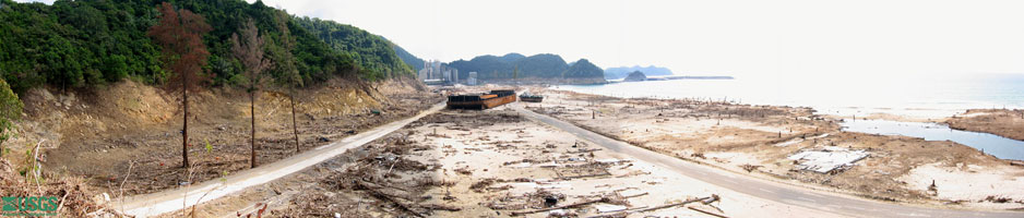
The powerful tsunami waves snapped off trees, swept buildings from their foundations, and stranded the coal barge and tugboat shown in this photograph taken south of Lho Nga looking southward. The line along the cliff where thick green vegetation (above) meets brown rock and rubble (below) marks the elevation reached by tsunami waves here: 31 m (102 ft) above sea level.
View large photo, 26"x6", load time 41 seconds with 56K modem
View larger photo, 65"x14", load time < 4 minutes with 56K modem
tsunami/sumatra05/Lho_Nga/merge2.html
contact Guy Gelfenbaum
last modified 2005