Map of western Sumatra showing approximate location of survey team each day.
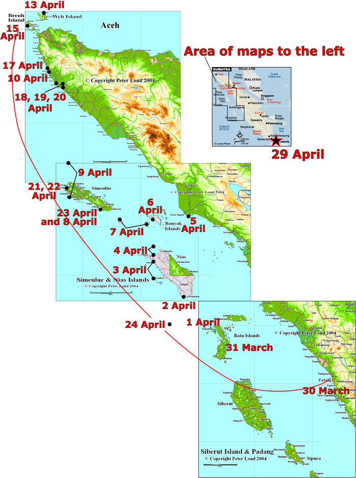
Map of western Sumatra showing approximate location of survey team each day. Long line represents the area of the survey; dates, dots, and stars indicate approximate locations of the survey team when the daily reports were given. For more information, see the daily USGS field reports. See a larger version of the map. Base maps of Indonesia © copyright Peter Loud 2004; used with permission. Additional maps at URL http://www.peteloud.co.uk/.
