Other ID: none
Status: Completed
Organization(s): USGS, Woods Hole Coastal and Marine Science Center
Funding Program(s):
Principal Investigator(s): Bradford Butman
Affiliate Investigator(s): John Vermersch - MIT
Information Specialist(s):
Data Type(s): Time Series: Mooring (physical oceanography)
Scientific Purpose/Goals: Replace instruments on moorings GBK2 and GBK3 and inspect mooring hardware.
Vehicle(s):
Start Port/Location: Vineyard Haven, MA
End Port/Location: Woods Hole, MA
Start Date: 1975-12-04
End Date: 1975-12-06
Equipment Used: Bottom platform
Information to be Derived: Time series data;
Summary of Activity and Data Gathered: Replaced VACM (102) on GBK2; 1/2 in. chain showed no wear since deployment in September from USCGC HORNBEAM. Attempted to recover mooring GBK3 at the same site, but high swells strained hauling equipment so recovery attempt was aborted. Mooring was redeployed at its original position (40d51minN, 67d25minW).
Staff:
Affiliate Staff:
John Vermersch - MIT
Notes:
Location:
Georges Bank, United States, North America, North Atlantic,
| Boundaries | |||
|---|---|---|---|
| North: 40.88029061 | South: 40.72366843 | West: -67.51741799 | East: -67.2074403 |
Platform(s):
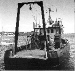
 Whitefoot |
Moody, J.A., and Butman, B., 1980, Semidiurnal bottom pressure and tidal currents on Georges Bank and in the Mid-Atlantic Bight: U.S. Geological Survey Open-File Report 80-1137, https://doi.org/10.3133/ofr801137.
Moody, J.A., Butman, B., Beardsley, R.C., Brown, W.S., Daifuku, P., Irish, J.D., Mayer, D.A., Mofjeld, H.O., Petrie, B., Ramp, S., Smith, P., and Wright, W.R., 1984, Atlas of tidal elevation and current observations on the Northeast American continental shelf and slope: U.S. Geological Survey Bulletin 1611, https://doi.org/10.3133/b1611.
| Title | Survey Equipment | Description |
|---|---|---|
| Cruise report | Bottom platform | Chief Scientist's cruise report includes track map with transit line and mooring location. |
| Survey Equipment | Survey Info | Data Type(s) | Data Collected |
|---|---|---|---|
| Bottom platform | --- | Mooring (physical oceanography) | 1975-031-FA-OM-001 (Georges Bank Sediment mooring data) |