Other ID: OC 13-3
Status: Completed
Organization(s): USGS, Woods Hole Coastal and Marine Science Center
Funding Program(s):
Principal Investigator(s): Bradford Butman, David W. Folger
Affiliate Investigator(s): Robert C. Beardsley - WHOI
Information Specialist(s):
Data Type(s): Environmental Data: CTD, Environmental Data: Temperature, Environmental Data: Turbidity, Sampling: Chemistry, Time Series: Mooring (physical oceanography)
Scientific Purpose/Goals: 1. Measure distribution of temperature and salinity in the vicinity of Georges Bank and along the shelf west of Georges Bank to acquire a synoptic picture of the regional density field to aid in interpretation of current meter records and to study mixing and transport in the Georges Bank region of the New England Continental Shelf. 2. Measure the distribution of suspended matter using optical techniques in the vicinity of Georges Bank and along the shelf west of Georges Bank. Collect and filter water samples to calibrate the optical sensor and to determine the composition of suspended material. These measurements are designed to study seston flux in the region. 3. Recover USGS moorings 107, 108, 109, 110, and 111. 4. Deploy USGS mooring 115.
Vehicle(s):
Start Port/Location: Woods Hole, MA
End Port/Location: Woods Hole, MA
Start Date: 1976-08-12
End Date: 1976-08-23
Equipment Used: SBE 9 CTD, Montedoro Whitney transmissometer with nephelometer, Niskin bottle, Nansen bottles, XBT, Bottom platform
Information to be Derived: Time series data; Suspended sediment concentrations;
Summary of Activity and Data Gathered: Moorings recovered: 5 (#107, 109 and 110 deployed FA 76008 HORNBEAM Mar. 29-31, 1976; #108 and 111 deployed FA 76006 HORNBEAM Mar. 8-11, 1976). Mooring deployed: 1 (#115 recovered FA 76047 OCEANUS 17 Dec. 3-10, 1976). CTD profiles: 111; XBT profiles: 142; Surface water (salinity) samples: 242; Deep calibration (temp. and salinity) samples: 96; Transmissometer profiles: 70; Suspended matter water samples: 186.
Staff: Michael Bothner, Bradford Butman, David W. Folger, Marlene Noble
Affiliate Staff:
Randy Fabro - phys. sci. tech.; WHOI: Robert C. Beardsley - co-Ch. Sci.
John A. Vermersch - research assoc.
John Milliman - assoc. sci.
Carol Parmenter - research assist.
Richard Limeburner - student; Eliason Data Services: Andrew Eliason; MIT: Frederick Faller - student
Notes: Original Center People field contained: Brad Butman - co-Ch. Sci.; Dave Folger - co-Ch. Sci.; Mike Bothner - geologist, Randy Fabro - phys. sci. tech., Marlene Noble - physicist.
Project = Sediment Dynamics, Sediment Dynamics
Location:
Georges Bank, North Atlantic Bight, United States, North America, North Atlantic;
| Boundaries | |||
|---|---|---|---|
| North: 42.2 | South: 39.25 | West: -72 | East: -65 |
Platform(s):
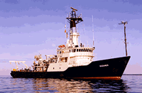
 Oceanus |
Moody, J.A., and Butman, B., 1980, Semidiurnal bottom pressure and tidal currents on Georges Bank and in the Mid-Atlantic Bight: U.S. Geological Survey Open-File Report 80-1137, https://doi.org/10.3133/ofr801137.
Moody, J.A., Butman, B., Beardsley, R.C., Brown, W.S., Daifuku, P., Irish, J.D., Mayer, D.A., Mofjeld, H.O., Petrie, B., Ramp, S., Smith, P., and Wright, W.R., 1984, Atlas of tidal elevation and current observations on the Northeast American continental shelf and slope: U.S. Geological Survey Bulletin 1611, https://doi.org/10.3133/b1611.
| Title | Survey Equipment | Description |
|---|---|---|
| Cruise report | (document not focused on specific equipment) | Chief Scientist's cruise report of ship movement, personnel, equipment and data acquisition. Includes trackmaps with mooring locations as well as diagram of mooring layout. |
| Cruise report | (document not focused on specific equipment) | WHOI cruise report including trackmaps. |
| Survey Equipment | Survey Info | Data Type(s) | Data Collected |
|---|---|---|---|
| SBE 9 CTD | --- | CTD | |
| Montedoro Whitney transmissometer with nephelometer | --- | Turbidity | |
| Niskin bottle | --- | Chemistry | |
| Nansen bottles | --- | Temperature Chemistry | |
| XBT | --- | Temperature | |
| Bottom platform | --- | Mooring (physical oceanography) | 1976-031-FA-OM-001 (Georges Bank Sediment mooring data) |