Other ID: S-1-87-SC
Status: Completed
Organization(s): USGS, Woods Hole Coastal and Marine Science Center
Funding Program(s):
Principal Investigator(s): Bradford Butman
Affiliate Investigator(s):
Information Specialist(s):
Data Type(s): Sampling: Geology, Time Series: Mooring (physical oceanography), Sonar: Sidescan
Scientific Purpose/Goals: This cruise was conducted as part of the sediment transport project of the California OCS Phase II Monitoring Program. The objectives of the cruise were to: 1) conduct a sidescan sonar survey at three locations (in the vicinity of regional stations R8, PJ1, and R9, stations A, B and C, respectively); 2) deploy subsurface current moorings at these three sites; 3) deploy GEOPROBES at stations A and B; 4) collect box cores for detailed sediment analysis; and 5) conduct a hydrographic and suspended matter survey on three cross-slope transects.
Vehicle(s):
Start Port/Location: Ventura, CA
End Port/Location: Ventura, CA
Start Date: 1987-05-05
End Date: 1987-05-09
Equipment Used: Sidescan sonar, Box corer, Bottom platform
Information to be Derived: Time series data; Samples and chemical analysis; Grain size analysis; Suspended sediment concentrations;
Summary of Activity and Data Gathered: All major objectives of the R/V SPROUL cruise were accomplished despite temporary failure of the sidescan and CTD systems. The sidescan sonar survey revealed several interesting features. The sea floor around Station R8 was generally featureless. Around the site-specific sampling array, numerous trawl marks and whale gouges were observed. Numerous large pits, 5-10 m diameter, were observed at Station R9 as well as trawl marks. The pits may be caused by shallow gas. Moorings deployed: 3 (#324, recovered FA 87038 ALOHA Sep. 14-17, 1987; #325 and 326, no recovery information).
Staff: Bradford Butman, John Moody, William J. Strahle
Affiliate Staff:
USGS-Menlo Park: Dave Drake
George Tate
Rick Vale
Jim Nicholson; WHOI: Cheryl Ann Butman
Chris Webb; Minerals Management Service: Gary Brewer; Battelle
Ventura
CA: Jim Campbell; International Underwater Contractors: Bill Crowley
Notes:
Location:
Point Sal, Ventura, California, United States, North America, North Pacific;
| Boundaries | |||
|---|---|---|---|
| North: 35 | South: 34.66667 | West: -121.367 | East: -120.68333 |
Platform(s):
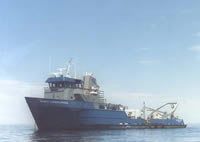 Robert Gordon Sproul |
| Title | Survey Equipment | Description |
|---|---|---|
| Cruise report | (document not focused on specific equipment) | Chief Scientist's report including personnel, summary and highlights, daily narrative, table of mooring deployment locations, hydrographic station locations, core locations, and trackmap. |
| Survey Equipment | Survey Info | Data Type(s) | Data Collected |
|---|---|---|---|
| Sidescan sonar | --- | Sidescan | |
| Box corer | --- | Biology Geology | |
| Bottom platform | --- | Mooring (physical oceanography) | 1987-017-FA-OM-001 (mooring data) |
