Other ID: OC328-2A
Status: Completed
Organization(s): USGS, Woods Hole Coastal and Marine Science Center
Funding Program(s):
Principal Investigator(s): Marinna Martini
Affiliate Investigator(s): David Townsend - U. Maine
Information Specialist(s):
Data Type(s): Environmental Data: CTD, Environmental Data: Current, Sampling: Chemistry, Time Series: Mooring (physical oceanography), Sampling: Geology
Scientific Purpose/Goals: This is the last in the ECOHAB-GOM project cruises for 1998 to study ecology and oceanography of toxic Alexandrium blooms in the Gulf of Maine. Purpose is to recover instrument surface mooring array deployed earlier in the year along the Maine coast and southwest corner of Nova Scotia. Seven surface moorings and 1 tripod (#521) will be recovered. Other scientific activities will include an intensive hydrographic survey including >200 CTD/rosette casts, net tows, submersible pump lowerings, small diameter gravity cores and ADCP data collection.
Vehicle(s):
Start Port/Location: Portland, ME
End Port/Location: Portland, ME
Start Date: 1998-08-06
End Date: 1998-08-16
Equipment Used: CTD 19+ with OBS, PAR, DO, Chl, Niskin bottle, ADCP, Gravity corer, Bottom platform
Information to be Derived: Time series data; Samples and chemical analysis; Grain size analysis;
Summary of Activity and Data Gathered: Moorings recovered: 2 (#520 and 521 deployed FA 98025 OCEANUS Mar. 30 - Apr. 3, 1998).
Staff:
Affiliate Staff:
U. Maine: David Townsend - Ch. Sci.
Neal Pettigrew
John Wallinga
Robert Stessel
Keska Kemper; NOAA/NMF: Wendy Milligan; UNH: Rebecca Clauss
Jill Torregiani; UMass/Dartmouth: John Kieser
Jefferson Turner; Vigo U.: Isabel Estraviz; U. Wisconsin: Anni Ala; WHOI: Rochelle Ugstad; Bigelow Lab: Mary Ann Brainard
Notes: University of Maine cruise; recovered USGS moorings #520 and 521. No USGS personnel aboard.
Project = ECOHAB-GOM, ECOHAB-GOM
Location:
Jordan Basin, Gulf of Maine, Maine, United States, North America, North Atlantic;
| Boundaries | |||
|---|---|---|---|
| North: 44.55 | South: 43.5 | West: -67.7 | East: -67.6 |
Platform(s):
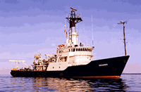
 Oceanus |
| Survey Equipment | Survey Info | Data Type(s) | Data Collected |
|---|---|---|---|
| CTD 19+ with OBS, PAR, DO, Chl | --- | CTD | |
| Niskin bottle | --- | Chemistry | |
| ADCP | --- | Current | |
| Gravity corer | --- | Geology | |
| Bottom platform | --- | Mooring (physical oceanography) | 1998-062-FA-OM-001 (ECOHAB II mooring data) |