Other ID: none
Status: Completed
Organization(s): USGS, Woods Hole Coastal and Marine Science Center
Funding Program(s):
Principal Investigator(s): Marinna Martini
Affiliate Investigator(s): Ron Schlitz - NMFS
Information Specialist(s): Frances Lightsom
Data Type(s): Imagery: Photo, Imagery: Video, Time Series: Mooring (physical oceanography)
Scientific Purpose/Goals: Recovery of mooring numbers 555-567. Instruments downloaded and maintained. Tripods and moorings re-deployed at locations to the west of the previous 7 sites. New sites occupy mooring numbers 573-590.
Vehicle(s):
Start Port/Location: Woods Hole, MA
End Port/Location: Woods Hole, MA
Start Date: 1999-06-14
End Date: 1999-06-23
Equipment Used: ROV, Bottom platform
Information to be Derived: Time series data;
Summary of Activity and Data Gathered: Moorings recovered: 13 (#555, 556, 557, 558, 559, 560, 561, 562, 563, 564, 565, 566 and 567, all deployed FA 99003 OCEANUS OC339 Mar. 17-25, 1999). Moorings deployed: 17 (#573, 574, 575, 576, 577, 578, 579, 581, 582, 583, 584, 585, 586, 587, 588 and 589, all recovered FA 99005 OCEANUS OC347 Aug. 25-31, 1999; and #580, unrecovered).
Staff: Robert Barton, Jonathan Borden, Jessica M. Cote, Jason Hyatt, Marinna Martini, Joseph S. Newell
Affiliate Staff:
Brian Guest - WHOI
Notes: Original Center People field contained: At sea crew: Jonathan Borden, Marinna Martini, Jessica Cote, Jason Hyatt; Mobilization support: Robert Barton, Joseph Newell. Original Submitted By field contained: Marinna Martini; edited by Jessica M. Cote.
Project = Globec III, Globec III
Location:
Georges Bank, United States, North America, North Atlantic,
| Boundaries | |||
|---|---|---|---|
| North: 41.20758836 | South: 40.99763556 | West: -67.48547626 | East: -67.18566743 |
Platform(s):
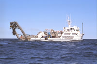
 Edwin Link |
| Survey Equipment | Survey Info | Data Type(s) | Data Collected |
|---|---|---|---|
| ROV | --- | Photo Video Biology Geology | |
| Bottom platform | --- | Mooring (physical oceanography) | 1999-004-FA-OM-001 (Globec mooring data) |