Other ID: MH38-02
Status: Completed
Organization(s): USGS, Woods Hole Coastal and Marine Science Center
Funding Program(s):
Principal Investigator(s): Michael Bothner
Affiliate Investigator(s): Joanne Goudreau, William Martin - WHOI
Information Specialist(s): Frances Lightsom
Data Type(s): Environmental Data: Dissolved Oxygen, Geochemical: Experiments (geochemical), Imagery: Photo, Sampling: Geology, Time Series: Mooring (physical oceanography)
Scientific Purpose/Goals: Exchange moored instruments and collect sediment samples at the USGS long-term stations near Buoy B in Massachusetts Bay and offshore of Scituate.
Vehicle(s):
Start Port/Location: U.S. Coast Guard Base, Boston, MA
End Port/Location: U.S. Coast Guard Base, Boston, MA
Start Date: 2002-02-05
End Date: 2002-02-06
Equipment Used: Oxygen profiling system from Sayles, Benthic Chambers, Slow corer, Camera- deep sea, Bottom platform
Information to be Derived:
Summary of Activity and Data Gathered: Moorings recovered: 5 (#649 deployed FA 01013 MARCUS HANNA May 23, 2001, recovered and redeployed FA 01068 CHRISTOPHER ANDREW Aug. 16, 2001, recovered FA 02026 MARCUS HANNA Feb. 5-6, 2002; #664 and 665 both deployed FA 01024 MARCUS HANNA Oct. 23, 2001; #666 and 667 both deployed FA 01080 CHRISTOPHER ANDREW Oct. 26-30, 2001). Moorings deployed: 5 (#682, 683, 684, 685 and 686, all recovered FA 02045 MARCUS HANNA May 21-22, 2002).
Staff: Dann Blackwood, Jonathan Borden, Michael Bothner, Michael Casso, Sarah Fuller, Marinna Martini, Joseph S. Newell, Richard Rendigs, Joanne Sedlock, Flavia Wood, Charles Worley
Affiliate Staff:
William Martin and Joanne Goudreau from WHOI who will deploy the oxygen profiler on the 2nd day of the cruise.
Notes: Chuck Worley and Dann Blackwood are designated to dive if the large tripod is not recovered in the normal way. Extra cores collected at Station 3 for WHOI processing at the Coast Guard dock. Problem with the bottom sealing mechanism (cheese slicer) on the slow corer. Original Center People field contained: Scientists at sea: Dann Blackwood, Jonathan Borden*, Mike Bothner, Michael Casso, Sarah Fuller*, Marinna Martini*, Richard Rendigs, Joanne Sedlock*, Flavia Wood, Charles Worley*. Mob and demobe: Joseph Newell*. Asterisk (*) denotes acct. 67013; otherwise acct. 67011.
Project = Massachusetts Bay Experiment, Massachusetts Bay Experiment
Location:
Massachusetts Bay, Scituate, Massachusetts, United States, North America, North Atlantic;
| Boundaries | |||
|---|---|---|---|
| North: 42.39900947 | South: 41.98694244 | West: -70.84517248 | East: -69.98262125 |
Platform(s):
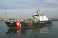 Marcus Hanna |
Bothner, M.H., and Butman, Bradford (eds.), 2007, Processes influencing the transport and fate of contaminated sediments in the coastal ocean—Boston Harbor and Massachusetts Bay: U.S. Geological Survey Circular 1302, 89 p., https://doi.org/10.3133/cir1302.
Bothner, M.H., Butman, B., and Casso, M.A., 2010, Review of oceanographic and geochemical data collected in Massachusetts Bay during a large discharge of total suspended solids from Boston’s sewage-treatment system and ocean outfall in August 2002: U.S. Geological Survey Open-File Report 2010–1050, 11 p., at https://doi.org/10.3133/ofr20101050.
Butman, B., Alexander, P.S., and Bothner, M.H., 2004, Time-Series photographs of the sea floor in western Massachusetts Bay—May to September 1999; May to September 2000; and October 2001 to February 2002: U.S. Geological Survey Data Series 97, https://doi.org/10.3133/ds97.
Butman, B., Bothner, M.H., Alexander, P.S., Lightsom, F.L., Martini, M.A., Gutierrez, B.T., and Strahle, W.S., 2004, Long-term oceanographic observations in western Massachusetts Bay offshore of Boston, Massachusetts; data report for 1989-2002: U.S. Geological Survey Digital Data Series DDS-74, Version 2.0, DVD-ROM, URL: https://doi.org/10.3133/ds74_v2.
Butman, B., Dalyander, P.S., Bothner, M.H., Borden, J., Casso, M.A., Gutierrez, B.T., Hastings, M.E., Lightsom, F.L., Martini, M.A., Montgomery, E.T., Rendigs, R.R., and Strahle, W.S., 2009, Long-term oceanographic observations in Massachusetts Bay, 1989 - 2006 (version 3): U.S. Geological Survey Data Series 74, https://doi.org/10.3133/ds74.
Butman, B., Dalyander, P.S., Bothner, M.H., and Lange, W.N., 2008, Time-series photographs of the sea floor in western Massachusetts Bay, 1996 - 2005: U.S. Geological Survey Data Series 266, https://doi.org/10.3133/ds266.
Kalnejais, L.H., Martin, William R., Signell, Richard P., and Bothner, Michael H., 2007, Role of sediment resuspension in the remobilization of particulate-phase metals from coastal sediments: Environmental Science and Technology, v. 41 no. 7, doi: 10.1021/es061770z.
Warner, J.C., Butman, B., and Dalyander, P. S., 2008, Storm-driven sediment transport in Massachusetts Bay: Continental Shelf Research, v. 28 no. 2, doi: 10.1016/j.csr.2007.08.008.
Warner, J.C., Sherwood, Christopher R., Signell, Richard P., Harris, Courtney K., and Arango, Hernan G., 2008, Development of a three-dimensional, regional, coupled wave, current, and sediment-transport model: Computers and Geosciences, v. 34 no. 10, doi: 10.1016/j.cageo.2008.02.012.
| Survey Equipment | Survey Info | Data Type(s) | Data Collected |
|---|---|---|---|
| Oxygen profiling system from Sayles | --- | Dissolved Oxygen | |
| Benthic Chambers | --- | Experiments (geochemical) | |
| Slow corer | --- | Geology | 2002-026-FA-SC-001 (CORE samples) |
| Camera- deep sea | --- | Photo | 2002-026-FA-PH-001 (Deck photos of field activity operations) |
| Bottom platform | --- | Mooring (physical oceanography) | 2002-026-FA-OM-001 (Western Mass Bay mooring data) |
