Other ID: MH47-05
Status: Completed
Organization(s): USGS, Woods Hole Coastal and Marine Science Center
Funding Program(s):
Principal Investigator(s): Michael Bothner
Affiliate Investigator(s):
Information Specialist(s): Michael Casso, Frances Lightsom
Data Type(s): Environmental Data: Dissolved Oxygen, Imagery: Photo, Imagery: Video, Location-Elevation: Navigation, Time Series: Mooring (physical oceanography)
Scientific Purpose/Goals: Exchange moorings and collect sediment cores at long-term sites in Massachusetts Bay.
Vehicle(s):
Start Port/Location: U.S. Coast Guard Base, Boston, MA
End Port/Location: U.S. Coast Guard Base, Boston, MA
Start Date: 2005-02-09
End Date: 2005-02-09
Equipment Used: Oxygen profiling system from Sayles, Video camera - deep sea, Digital camera, DGPS, Bottom platform
Information to be Derived: Time series data; Samples and chemical analysis; Grain size analysis;
Summary of Activity and Data Gathered: No diving was required. Moorings recovered: 1 (#775 deployed FA 04032 ABBIE BURGESS Sep. 22-23, 2004). Moorings deployed: 2 (#776 and 777 both recovered FA 05022 MARCUS HANNA May 18-19, 2005). The subsurface mooring #774 released on Dec. 31 when the anchor connection failed. It was recovered by Frank Mirarchi on the F/V CHRISTOPHER ANDREW (FA 04065). The tripod #775 was tipped over on Nov. 15. In spite of a tangled recovery line, we were able to get it on board the MARCUS HANNA without incident on Feb. 9. Four cores were collected at Station 3, three cores at Station 2. The oxygen profiler was deployed twice at Station 3. One deployment of the oxygen profiler was made at Station 2. A refurbished tripod and subsurface mooring were deployed near the B Buoy.
Staff: Sandy Baldwin, Dann Blackwood, Jonathan Borden, Michael Bothner, Michael Casso, Marinna Martini, Richard Rendigs, Stephen Ruane
Affiliate Staff:
Joanne Goudreau
Scientist (WHOI) - deploy oxygen profiler
Notes: Original Center People field contained: Science crew: Sandy Baldwin*, Dann Blackwood*, Jonathan Borden, Mike Bothner, Michael Casso, Marinna Martini, Richard Rendigs*, Stephen Ruane. Asterisk (*) denotes acct. 2921-BOF96; otherwise acct. 2921-BOF86.
Project = Coastal Geologic Processes: Enviro. Change in the NE U.S., Coastal Geologic Processes: Enviro. Change in the NE U.S.
Location:
Massachusetts Bay, Massachusetts, United States, North America, North Atlantic,
| Boundaries | |||
|---|---|---|---|
| North: 42.4 | South: 42.33333 | West: -71.1667 | East: -70.66667 |
Platform(s):
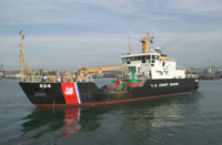 Marcus Hanna |
Bothner, M.H., and Butman, Bradford (eds.), 2007, Processes influencing the transport and fate of contaminated sediments in the coastal ocean—Boston Harbor and Massachusetts Bay: U.S. Geological Survey Circular 1302, 89 p., https://doi.org/10.3133/cir1302.
Butman, B., Bothner, M.H., Alexander, P.S., Lightsom, F.L., Martini, M.A., Gutierrez, B.T., and Strahle, W.S., 2004, Long-term oceanographic observations in western Massachusetts Bay offshore of Boston, Massachusetts; data report for 1989-2002: U.S. Geological Survey Digital Data Series DDS-74, Version 2.0, DVD-ROM, URL: https://doi.org/10.3133/ds74_v2.
Butman, B., Dalyander, P.S., Bothner, M.H., Borden, J., Casso, M.A., Gutierrez, B.T., Hastings, M.E., Lightsom, F.L., Martini, M.A., Montgomery, E.T., Rendigs, R.R., and Strahle, W.S., 2009, Long-term oceanographic observations in Massachusetts Bay, 1989 - 2006 (version 3): U.S. Geological Survey Data Series 74, https://doi.org/10.3133/ds74.
Butman, B., Dalyander, P.S., Bothner, M.H., and Lange, W.N., 2008, Time-series photographs of the sea floor in western Massachusetts Bay, 1996 - 2005: U.S. Geological Survey Data Series 266, https://doi.org/10.3133/ds266.
| Survey Equipment | Survey Info | Data Type(s) | Data Collected |
|---|---|---|---|
| Oxygen profiling system from Sayles | --- | Dissolved Oxygen | |
| Video camera - deep sea | --- | Video | |
| Digital camera | --- | Photo | 2005-003-FA-PH-001 (Deck photos of field activity operations) |
| DGPS | --- | Navigation | |
| Bottom platform | --- | Mooring (physical oceanography) | 2005-003-FA-OM-001 (Western Mass Bay mooring data) |
