Other ID: none
Status: Completed
Organization(s): USGS, Woods Hole Coastal and Marine Science Center
Funding Program(s):
Principal Investigator(s): Walter Barnhardt
Affiliate Investigator(s):
Information Specialist(s): Seth Ackerman
Data Type(s): Biological Field Study: Experiments (biological), Biological Field Study: Surveys (biological), Imagery: Photo, Imagery: Video, Location-Elevation: Navigation, Sampling: Biology, Sampling: Geology, Visual Identification: Species ID
Scientific Purpose/Goals: Ground validation of geophysical mapping done in previous surveys: bottom sampling, photography, and coring.
Vehicle(s):
Start Port/Location: Woods Hole, MA
End Port/Location: Woods Hole, MA
Start Date: 2007-09-06
End Date: 2007-09-15
Equipment Used: DGPS, SeaBOSS, Alpine Vibracorer, Digital camera
Information to be Derived: Samples and chemical analysis; Grain size analysis; Sea floor map;
Summary of Activity and Data Gathered: The survey occupied xx stations on the inner shelf off the South Shore coast and northern Cape Cod Bay (the areas previously surveyed with geophysics in cruises FA 06012, FA 07001, and FA 07002). Photographic data were collected at 183 stations; grab samples were collected at 128 stations. Seventeen vibracores were collected, ranging up to 4.2 m long.
Staff: Seth Ackerman, Walter Barnhardt, Dann Blackwood, Brian Buczkowski, Emily Himmelstoss, Charles Worley
Affiliate Staff:
Notes: Project = Geologic mapping of the Massachusetts inner shelf, Geologic mapping of the Massachusetts inner shelf
Information from Foghorn: SEABOSS and Rossfelder vibracorer (borrowed from WHOI);
Location:
Cape Cod Bay, Massachusetts, United States, North America, North Atlantic,
| Boundaries | |||
|---|---|---|---|
| North: 42.32301645 | South: 41.92407858 | West: -70.81574228 | East: -70.18523723 |
Platform(s):
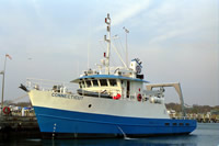
 Connecticut |
Andrews, B.D., Ackerman, S.D., Baldwin, W.E., and Barnhardt, W.A., 2010, Geophysical and sampling data from the inner continental shelf—Northern Cape Cod Bay, Massachusetts: U.S. Geological Survey Open-File Report 2010–1006, 1 DVD-ROM, available at https://doi.org/10.3133/ofr20101006.
Pendleton, E.A., Baldwin, W.E., Barnhardt, W.A., Ackerman, S.D., Foster, D.S., Andrews, B.D., and Schwab, W.C., 2013, Shallow geology, seafloor texture, and physiographic zones of the Inner Continental Shelf from Nahant to northern Cape Cod Bay, Massachusetts: U.S. Geological Survey Open-File Report 2012–1157, 53 p., https://doi.org/10.3133/ofr20121157.
FAN 2007-003-FA has data viewable in the CMGP Video and Photograph Portal. View the data in this application here. See the instructions for working with this application.
| Title | Survey Equipment | Description |
|---|---|---|
| Sample log | (document not focused on specific equipment) | Log of SEABOSS and coring samples including date, time, description. Cores have lat/long coordinates. Also has personnel and equipment lists. |
| Survey Equipment | Survey Info | Data Type(s) | Data Collected |
|---|---|---|---|
| DGPS | --- | Navigation | |
| SeaBOSS | --- | Surveys (biological) Experiments (biological) Species ID Photo Video Geology Biology | 2007-003-FA-VD-002 (18-dvd set of down-looking bottom video. ) 2007-003-FA-SC-001 (grab samples) |
| Alpine Vibracorer | --- | Geology | |
| Digital camera | --- | Photo | 2007-003-FA-PH-001 (Deck photos of field activity operation) |