Other ID: none
Status: Completed
Organization(s): USGS, Woods Hole Coastal and Marine Science Center
Funding Program(s):
Principal Investigator(s): Lawrence Poppe
Affiliate Investigator(s): Matt Liebman, EPA; Deb Pacileo, CT DEP
Information Specialist(s): Dann Blackwood, Lawrence Poppe
Data Type(s): Biological Field Study: Experiments (biological), Biological Field Study: Surveys (biological), Imagery: Photo, Imagery: Video, Location-Elevation: Navigation, Sampling: Biology, Sampling: Geology, Visual Identification: Species ID
Scientific Purpose/Goals: Verify multibeam and sidescan sonar datasets in eastern Long Island Sound.
Vehicle(s):
Start Port/Location: New London, CT
End Port/Location: New London, CT
Start Date: 2010-05-24
End Date: 2010-05-28
Equipment Used: SeaBOSS, Digital camera, GPS (wh)
Information to be Derived:
Summary of Activity and Data Gathered: Bottom sampling and photography were performed to ground-truth NOAA hydrographic surveys H11997, H11999, and H12012. Nine of the stations were occupied in support of a CT DEP Marine Fisheries project.
Staff: Dann Blackwood
Affiliate Staff:
Marcel Balaval
EPA
Jared Balavender
CT DEP
Marilyn St. Fleur
EPA
Mike Gobell
URI
John Gobell
volunteer
Notes: Project = Geology of the State of Connecticut, Geology of the State of Connecticut
Location:
Long Island Sound, New York, Connecticut, United States, North America, North Atlantic,
| Boundaries | |||
|---|---|---|---|
| North: 41.3397 | South: 41.00685 | West: -72.6718 | East: -72.09503 |
Platform(s):
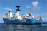 OSV Bold |
McMullen, K.Y., Poppe, L.J., Danforth, W.W., Blackwood, D.S., Schaer, J.D., Glomb, K.A., and Doran, E.F., 2012, Sea-floor geology of Long Island Sound north of Duck Pond Point, New York: U.S. Geological Survey Open-File Report 2011-1149, https://doi.org/10.3133/ofr20111149.
McMullen, K.Y., Poppe, Lawrence J., Ackerman, Seth D., Danforth, William W., Schaer, Jasper D.,, 2012, Sea-Floor Geology in Long Island Sound, Offshore of the North Fork of Long Island, New York [abs.]: , Long Island Sound Research Conference. Stony Brook, NY, November 1-2, 2012.
Poppe, L.J., Ackerman, S.D., McMullen, K.Y., and Schaer, J.D., 2012, Sedimentary environments and processes offshore in eastern Long Island Sound [abs.]: , 2012 AGU Ocean Sciences Meeting. Salt Lake City, UT, February 20-24, 2012.
Poppe, L.J., Danforth, W.W., McMullen, K.Y., Parker, C.E., and Doran, E.F., 2011, Combined multibeam and LIDAR bathymetry data from eastern Long Island Sound and westernmost Block Island Sound-A regional perspective: U. S. Geological Survey Open-File Report 2011-1003, https://doi.org/10.3133/ofr20111003.
Poppe, L.J., McMullen, K.Y., Ackerman, S.D., Blackwood, D.S., Shaer, J.D., Forrest, M.R., Ostapenko, A.J., and Doran, E.F., 2011, Sea-floor geology and topography, offshore in Eastern Long Island Sound: U.S. Geological Survey Open-File Report 2010-1150, https://doi.org/10.3133/ofr20101150.
Poppe, L.J., McMullen, K.Y., Ackerman, S.D., and Glomb, K.A., 2013, Sea-floor geology and topography offshore in northeastern Long Island Sound: U.S. Geological Survey Open-File Report 2013-1060, https://doi.org/10.3133/ofr20131060.
FAN 2010-015-FA has data viewable in the CMGP Video and Photograph Portal. View the data in this application here. See the instructions for working with this application.
| Survey Equipment | Survey Info | Data Type(s) | Data Collected |
|---|---|---|---|
| SeaBOSS | --- | Surveys (biological) Experiments (biological) Species ID Photo Video Geology Biology | |
| Digital camera | --- | Photo | 2010-015-FA-PH-002 (Deck photos of field operations) |
| GPS (wh) | --- | Navigation |
