Other ID: none
Status: Completed
Organization(s): USGS, St. Petersburg Coastal and Marine Science Center
Funding Program(s):
Principal Investigator(s): James Flocks
Affiliate Investigator(s):
Information Specialist(s): Nancy DeWitt, Dana Wiese
Data Type(s): Location-Elevation: Navigation, Location-Elevation: Profiles, Location-Elevation: Transects, Seismics: Sub Bottom Profiler, Sonar: Interferometric, Sonar: Multibeam, Sonar: Single Beam, Time Series: Mooring (physical oceanography)
Scientific Purpose/Goals: To create a complete modern topobathymetric map of the Mississippi barrier islands from Cat Island to Dauphin Island. Data to provide information for the following: sediment budget; assessment of immediate sand resources in the region, modern geologic framework; historical island change measurements; base-level assessment of the seafloor since the 2005 hurricane season
Vehicle(s):
Start Port/Location: Biloxi, Mississippi
End Port/Location: Biloxi, Mississippi
Start Date: 2008-07-08
End Date: 2008-07-21
Equipment Used: Choke Ring Antenna, TSS DMS-05 Motion Sensor, Interferometric Bathymetry System, Marimatech Echosounder, Ashtech Z-Xtreme DGPS, Chirp 424, Tripod
Information to be Derived: High precision single beam bathymetry (X, Y, Z), Submetrix swath bathymetry data; subbotom image profiles, high precision (X, Y, Z) shoreline topography.
Summary of Activity and Data Gathered:
Staff: Nancy DeWitt, Billy Reynolds, Dana Wiese
Affiliate Staff:
Notes: Additional Equipment: portable GPS topographic survey buggy. Platform: R/V Survey Cat.
Location:
Ship and Horn Island, MS
| Boundaries | |||
|---|---|---|---|
| North: 30.30132431 | South: 30.16596628 | West: -89.0289 | East: -88.53836124 |
Platform(s):
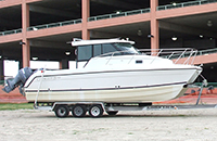 Glacier Bay Cat Boat |
Buster, N.A., Brenner, O.T., Flocks, J.G., 2017, Historical and recent coastal bathymetry data nearshore Ship, Horn, and Petit Bois Islands, Mississippi: U.S. Geological Survey data release, https://doi.org/10.5066/F7028QFV.
DeWitt, N.T., Flocks, J.G., Pendleton, E.A., Hansen, M.E., Reynolds, B.J., Kelso, K.W., Wiese, D.S., Worley, C.R., 2012, Archive of single beam and swath bathymetry data collected nearshore of the Gulf Islands National Seashore, Mississippi, from West Ship Island, Mississippi, to Dauphin Island, Alabama: Methods and data report for USGS cruises 08CCT01 and 08CCT02, July 2008 and 09CCT03 and 09CCT04, June 2009: U.S. Geological Survey Data Series 675, https://doi.org/10.3133/ds675.
Flocks, J.G., Buster, N.A., Brenner, O.T., 2020, Seafloor change around the Mississippi barrier islands, 1920 to 2016-The influence of storm effects on inlet and island morphodynamics: U.S. Geological Survey Open-File Report 2019-1140, 30 p., https://doi.org/10.3133/ofr20191140.
Flocks, J.G., Kindinger, J.L., Kelso, K.W., 2015, Geologic control on the evolution of the inner shelf morphology offshore of the Mississippi barrier islands, northern Gulf of Mexico, USA: Continental Shelf Research, v. 101, pp. 59–70, doi: 10.1016/j.csr.2015.04.008.
Forde, A.S., Dadisman, S.V., Flocks, J.G., DeWitt, N.T., Reynolds, B.J., Wiese, D.S., 2011, Archive of digital CHIRP sub-bottom profile data collected during USGS cruises 08CCT02 and 08CCT03, Mississippi Gulf Islands, July and September 2008: U.S. Geological Survey Data Series 569, https://doi.org/10.3133/ds569.
Lavoie, D.L., Flocks, J., Twichell, D., Rose, K.V., 2013, Benthic substrate classification map: Gulf Islands National Seashore: U.S. Geological Survey Open-File Report 2012-1051, 14 p., https://doi.org/10.3133/ofr20121051.
FAN 08CCT02 has data viewable in the GeoMappApp/Virtual Ocean applications. To view this data in these applications go to http://www.geomapapp.org/ and http://www.virtualocean.org/. See the instructions for locating USGS data in these applications. You can also view the imagery created from the SEGY data at https://cmgds.marine.usgs.gov/images.php?cruise=08CCT02.
| Survey Equipment | Survey Info | Data Type(s) | Data Collected |
|---|---|---|---|
| Choke Ring Antenna | --- | Benchmarks Navigation | No data was collected |
| TSS DMS-05 Motion Sensor | --- | Interferometric Single Beam | |
| Interferometric Bathymetry System | --- | Interferometric | 2008_2009_MS_NAD83NAVD88g12B_50m.zip (Interpolated DEM) 2016minus2008to2009_MS_ NAD83NAVD88g12B_50m.zip (Elevation change as a DEM, bathymetric change digital elevation model (DEM) observed between the 2008-2009 and 2016 bathymetry) 2008to2009minus1916to1920_MS_ NAD83NAVD88g12B_50m.zip (bathymetric change digital elevation model (DEM) observed between the 1916-1920 and 2008-2009 bathymetry) 2008_2009_MS_NAD83NAVD88g12B_XYZ.zip (updated elevation point data (xyz) in which NOAA's Vdatum version 3.6 was used convert the 2008-2009 XYZ soundings to Universal Transverse Mercator (UTM) North American Datum of 1983 (NAD83) horizontal datum and North American Vertical Datum of 1988 (NAVD88) GEOID12B vertical datum ) 08CCT02-BA-pd-4 (bathymetric (single-beam and swath) grid in ascii format, 50-m resolution) 08CCT02-BA-pd-2 (bathymetric (single-beam and swath) grid in point format, 50-m resolution) 08CCT02-BA-pd-3 (Data Series 675 GIS dataset) 08CCT02-BA-pd-1 (bathymetric (single-beam and swath) grid as GeoTiff, 50-m resolution) |
| Marimatech Echosounder | --- | Single Beam | |
| Ashtech Z-Xtreme DGPS | --- | Benchmarks Navigation | Processed Shotpoint Navigation Processed 1,000-Shot-Interval Location Navigation 08CCT02-SE-pd-4 (Chirp 424 data navigation) 08CCT02-NL-pd-1 (Trackline shapefiles for single-beam and swath bathymetry) |
| Chirp 424 | --- | Sub Bottom Profiler | Data Series 569 Segy (Chirp 424 data agc SEGY) Data Series 569 GIS (Chirp 424 data GIS) Data Series 569 Profiles (Chirp 424 data profiles) 08CCT02-SE-pd-5 (Chirp 424 data GeoMapApp) 08CCT02-SE-pd-6 (Chirp 424 data swell filtered) |
| Tripod | --- | Mooring (physical oceanography) Benchmarks Navigation | No data was collected |
