Other ID: none
Status: Completed
Organization(s): USGS, St. Petersburg Coastal and Marine Science Center
Funding Program(s):
Principal Investigator(s): James Flocks
Affiliate Investigator(s):
Information Specialist(s): Nancy DeWitt, Dana Wiese
Data Type(s): Location-Elevation: Benchmarks, Location-Elevation: Navigation, Location-Elevation: Profiles, Location-Elevation: Transects, Seismics: Sub Bottom Profiler, Sonar: Multibeam, Sonar: Sidescan
Scientific Purpose/Goals: An additional survey area off of Cat Island that will be incorporated into the complete modern topobathymetric map of the Mississippi barrier islands from Cat Island to Dauphin Island. Data to provide information for the following: assessment of immediate sand resources in the region, modern geologic framework; historical island change measurements
Vehicle(s):
Start Port/Location: Biloxi, Mississippi
End Port/Location: Biloxi, Mississippi
Start Date: 2010-03-09
End Date: 2010-03-17
Equipment Used: Sidescan Sonar, Chirp 424, Interferometric Bathymetry System, F190 DGPS/IMU
Information to be Derived: Submetrix swath bathymetry data (X, Y, Z); shallow sub-bottom image profiles, side-scan sonar mosaics
Summary of Activity and Data Gathered:
Staff: Nancy DeWitt, William Pfeiffer, Dana Wiese
Affiliate Staff:
Notes:
Location:
Cat Island, MS to Dauphin Island, AL
| Boundaries | |||
|---|---|---|---|
| North: 30.51777587 | South: 29.90938258 | West: -89.6251 | East: -87.32887588 |
Platform(s):
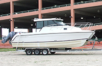 Glacier Bay Cat Boat |
DeWitt, N.T., Flocks, J.G., Pfeiffer, W.R., Forde, A.S., Wiese, D.S., 2011, Archive of sidescan sonar and swath bathymetry data collected during USGS cruise 10CCT01 offshore from Cat Island, Gulf Islands National Seashore, Mississippi, March 2010: U.S. Geological Survey Data Series 563, https://doi.org/10.3133/ds563.
Flocks, J., Forde, A., 2025, Shallow Geologic Framework of the Mississippi Sound and the Potential for Sediment Resources: U.S. Geological Survey Scientific Investigations Report (2025-5100), https://doi.org/10.3133/sir20255100.
Flocks, J.G., Kindinger, J., Kelso, K.W., Bernier, J.C., DeWitt, N.T., FitzHarris, M., 2015, Near-surface stratigraphy and morphology, Mississippi Inner Shelf, northern Gulf of Mexico: U.S. Geological Survey Open-File Report 2015-1014, 26 p., https://doi.org/10.3133/ofr20151014.
Flocks, J.G., Kindinger, J.L., Kelso, K.W., 2015, Geologic control on the evolution of the inner shelf morphology offshore of the Mississippi barrier islands, northern Gulf of Mexico, USA: Continental Shelf Research, v. 101, pp. 59–70, doi: 10.1016/j.csr.2015.04.008.
Forde, A.S., Dadisman, S.V., Flocks, J.G., Wiese, D.S., DeWitt, N.T., Pfeiffer, W.R., Kelso, K.W., Thompson, P.R., 2011, Archive of digital CHIRP sub-bottom profile data collected during USGS cruises 10CCT01, 10CCT02, and 10CCT03, Mississippi and Alabama Gulf Islands, March and April 2010: U.S. Geological Survey Data Series 611, https://doi.org/10.3133/ds611.
Gal, N.S., Wallace, D.J., Miner, M.D., Hollis, R.J., Dike, C., Flocks, J.G., 2021, Influence of antecedent geology on the Holocene formation and evolution of Horn Island, Mississippi, USA: Marine Geology, v. 431, 106375 p., doi: 10.1016/j.margeo.2020.106375.
Twichell, D.C., Pendleton, E.A., Flocks, J.G., Baldwin, W.E., Foster, D.S., 2011, The shallow stratigraphy and sand resources offshore of the western part of the Mississippi barrier islands: U.S. Geological Survey Open-File Report 2011-1173, https://doi.org/10.3133/ofr20111173.
FAN 10CCT01 has data viewable in the GeoMappApp/Virtual Ocean applications. To view this data in these applications go to http://www.geomapapp.org/ and http://www.virtualocean.org/. See the instructions for locating USGS data in these applications. You can also view the imagery created from the SEGY data at https://cmgds.marine.usgs.gov/images.php?cruise=10CCT01.
| Survey Equipment | Survey Info | Data Type(s) | Data Collected |
|---|---|---|---|
| Sidescan Sonar | --- | Sidescan | 10cct01_v2_ss_1m_b (Sidescan sonar mosaic as GeoTiff) |
| Chirp 424 | --- | Sub Bottom Profiler | 10CCT01-SE-pd-4 (Chirp 424 data GeoMapApp) 10CCT01-SE-pd-2 (Chirp 424 data profiles) 10CCT01-SE-pd-3 (Chirp 424 data GIS) 10CCT01-SE-pd-1 (Chirp 424 data navigation) 10CCT01-SE-pd-5 (Chirp 424 data agc SEGY) |
| Interferometric Bathymetry System | --- | Interferometric | Data series 563 arc (Data Series 563 GIS dataset) 10cct01_v2rbf_50m (Interferometric swath bathy grid as GeoTiff, 50-m resolution) 10cct01_xyzi (Interferometric swath bathy grid in ascii format, 50-m resolution) |
| F190 DGPS/IMU | --- | Navigation | Processed Shotpoint Navigation 10cct01_sw_tracklines (Swath navigation tracklines as Geotiff) 10cct01_ss_tracklines (Sidescan sonar navigation tracklines as Geotiff) 10CCT01-NL-pd-1 (HYPACK navigation tracklines as a shapefile) Processed 1,000-Shot-Interval Location Navigation |
