Other ID: none
Status: Completed
Organization(s): USGS, St. Petersburg Coastal and Marine Science Center
Funding Program(s):
Principal Investigator(s): James Flocks, Jennifer Miselis
Affiliate Investigator(s):
Information Specialist(s): Julie Bernier, Nancy DeWitt, Kyle Kelso, William Pfeiffer, Dana Wiese
Data Type(s): Location-Elevation: Benchmarks, Location-Elevation: Navigation, Location-Elevation: Profiles, Location-Elevation: Transects, Seismics: Sub Bottom Profiler, Sonar: Interferometric, Sonar: Multibeam, Sonar: Sidescan, Sonar: Sound Velocity
Scientific Purpose/Goals: Identifying sand resources for barrier island restoration
Vehicle(s):
Start Port/Location: Biloxi, MS
End Port/Location: Biloxi, MS
Start Date: 2013-08-12
End Date: 2013-08-12
Equipment Used: Chirp 424, F190 DGPS/IMU, Global Positioning System (GPS), Klein Side Scan Sonar, Valeport Mini Sound Velocity Probe, Valeport SVP, Interferometric Bathymetry System, TSS DMS-05 Motion Sensor
Information to be Derived: Sand isopach; seafloor morphology & lithology; subsurface stratigraphy
Summary of Activity and Data Gathered:
Staff: Julie Bernier, Nancy DeWitt, James Flocks, Kyle Kelso, William Pfeiffer, Dana Wiese
Affiliate Staff:
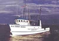
Notes: Platform: R/V Tommy Munro
MSCIP project
Location:
Petit Bois Pass, MS
| Boundaries | |||
|---|---|---|---|
| North: 30.37147653 | South: 30.06088655 | West: -88.6703 | East: -88.36967632 |
Platform(s):
 Tommy Munro |
DeWitt, N.T., Flocks, J.G., Kindinger, J.L., Bernier, J.C., Kelso, K.W., Wiese, D.S., Finlayson, D.P., Pfeiffer, W.R., 2015, Archive of sidescan sonar and swath bathymetry data collected during USGS Cruise 13CCT04 Offshore of Petit Bois Island, Gulf Islands National Seashore, Mississippi, August 2013: U.S. Geological Survey Data Series 917, https://doi.org/10.3133/ds917.
Flocks, J.G., Kindinger, J., Kelso, K.W., Bernier, J.C., DeWitt, N.T., FitzHarris, M., 2015, Near-surface stratigraphy and morphology, Mississippi Inner Shelf, northern Gulf of Mexico: U.S. Geological Survey Open-File Report 2015-1014, 26 p., https://doi.org/10.3133/ofr20151014.
Forde, A.S., Flocks, J.G., Kindinger, J.L., Bernier, J.C., Kelso, K.W., Wiese, D.S., 2015, Archive of digital chirp subbottom profile data collected during USGS Cruise 13CCT04 offshore of Petit Bois Island, Mississippi, August 2013: U.S. Geological Survey Data Series 924, https://doi.org/10.3133/ds924.
FAN 13CCT04 has data viewable in the GeoMappApp/Virtual Ocean applications. To view this data in these applications go to http://www.geomapapp.org/ and http://www.virtualocean.org/. See the instructions for locating USGS data in these applications. You can also view the imagery created from the SEGY data at https://cmgds.marine.usgs.gov/images.php?cruise=13CCT04.
| Survey Equipment | Survey Info | Data Type(s) | Data Collected |
|---|---|---|---|
| Chirp 424 | --- | Sub Bottom Profiler | DS 924 arc (Chirp 424 GIS dataset) DS 924 segy (Chirp 424 data agc SEGY) 13CCT04-SE-pd-2 (Chirp 424 data profiles) |
| F190 DGPS/IMU | --- | Navigation | |
| Global Positioning System (GPS) | --- | Navigation | DS 924 nav (Chirp 424 data navigation) |
| Klein Side Scan Sonar | --- | Sidescan | 13CCT04_SSS_01_ITRF05.zip (Sidescan Sonar Mosaic 1-m resolution) |
| Valeport Mini Sound Velocity Probe | --- | Sound Velocity | |
| Valeport SVP | --- | Sound Velocity | No data was collected |
| Interferometric Bathymetry System | --- | Interferometric | 13CCT04_IFB_tracklines.zip (Tracklines) 13CCT04_IFB_50_WGS84_G1150_MLLW_DEM.zip (Bathymetry DEM 50-m cell size) 13CCT04_GIS.zip (Esri ArcGIS project Bathymetry DEM 50-m cell size) 13CCT04_IFS_01_ITRF05.zip (Interferometric Backscatter Mosaic 1-m resolution) 13CCT04_IFB_xyz.zip (Swath samples 2-m BASE resolution) |
| TSS DMS-05 Motion Sensor | --- | Interferometric Single Beam | No data was collected |
