Other ID: ASTR 75-JUN
Status: Completed
Organization(s): USGS, Woods Hole Coastal and Marine Science Center
Funding Program(s):
Principal Investigator(s): Charles J. O'Hara
Affiliate Investigator(s):
Information Specialist(s): Charles J. O'Hara
Data Type(s): Location-Elevation: Navigation, Seismics: Boomer
Scientific Purpose/Goals: The cooperative program is designed to provide detailed geological information and an assessment of mineral resources pertaining to that part of the continental shelf beneath the coastal waters of Massachusetts. In anticipation of the development of offshore natural resources of the Commonwealth, the major focus of the research effort is directed toward the occurrance, nature and distribution of these deposits as well as establishment of baseline data for evaluation of environmental impact of exploitation. The sub-bottom profiling surveys provide the foundation for a planned program of vibracoring and bottom sampling of geological features. Laboratory analysis of the vibracore and bottom samples will evaluate the economic importance of the deposits and, coupled with the seismic data, provide information on the geology and geologic history of the area.
Vehicle(s):
Start Port/Location:
End Port/Location:
Start Date: 1975-06-19
End Date: 1975-06-30
Equipment Used: EG&G 234, Loran-C, Raytheon radar, Visual navigation, Single channel hydrophone
Information to be Derived:
Summary of Activity and Data Gathered: Traverses: 33 (27 in a NW-SE orientation with a line spacing of 1 nm, 6 in a SW-NE orientation with a line spacing of approximately 3 nm); Seismic data: 358 nm (663 km) and penetration of up to 125 meters below the bottom were achieved.
Staff: Susan Barton, Wayne Ferrebee, Patricia Forrestel, Frank W. Jennings, Charles J. O'Hara, Barbara Tausey, Elizabeth Winget
Affiliate Staff:
Notes: All seismic track lines were pre-plotted along LORAN-C navigation lines of position. This approach facilitated control of the survey vessel on the seismic tracks despite the course setting influence of wind and currents. Cape Race, Newfoundland and Dana, Indiana LORAN-C secondary transmitters were utilized as they are the most reliable and provide the best positional accuracy within the area. Navigational fixes were taken at 15 minute intervals and ship's speed over the bottom averaged 4.5 knots. The hydrophone array and catamaran float with mounted transducer were towed about 15 meters astern of the survey vessel. This configuration, coupled with ship's speed, resulted in a sound source/receiver separation of approximately 10 meters. The transducer was triggered every 0.5 second and the sweep rate of the recorder was set at 0.25 second. Only incoming seismic signals within the 200-4000 Hz frequency range were fed to the recorder. Original Center People field contained: Chuck O'Hara - Chief Scientist, Frank Jennings - Electronic Technician, Patricia Forrestal, Wayne Ferrebee, Elizabeth Winget, Susan Purdy, and Barbara Tausey.
Project = Marine Geologic Program, Marine Geologic Program
Location:
Rhode Island Sound, Rhode Island, Westport Harbor, Vineyard Sound, Cuttyhunk Island, Nomans Land, Martha's Vineyard, Massachusetts, United States, North America, North Atlantic;
| Boundaries | |||
|---|---|---|---|
| North: 41.5 | South: 41.25 | West: -71.25 | East: -70.7 |
Platform(s):
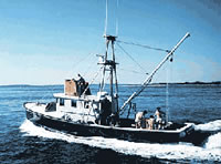
 Asterias |
McMullen, K.Y., Poppe, L.J., and Soderberg, N.K., 2009, Digital seismic-reflection data from eastern Rhode Island Sound and vicinity, 1975-1980: U.S. Geological Survey Open-File Report 2009-1003, 2 DVD-ROMs, URL: https://doi.org/10.3133/ofr20091003.
McMullen, K.Y., Poppe, L.J., Twomey, E.R., Danforth, W.W., Haupt, T.A., and Crocker, J.M., 2007, Sidescan-sonar imagery, multibeam bathymetry, and surficial geologic interpretations of the sea floor in Rhode Island Sound, off Sakonnet Point, Rhode Island: U.S. Geological Survey Open-File Report 2007-1150, https://doi.org/10.3133/ofr20071150.
O'Hara, C.J., 1980, High-resolution seismic-reflection profiling data from the inner continental shelf of southeastern Massachusetts: U.S. Geological Survey Open-File Report 1980-178, https://doi.org/10.3133/ofr80178.
O'Hara, C.J., and Oldale, R.N., 1980, Maps showing geology and shallow structure of eastern Rhode Island Sound and Vineyard Sound, Massachusetts: U.S. Geological Survey Miscellaneous Field Studies Map MF-1186, 5 sheets, 41 p., URL: https://doi.org/10.3133/mf1186.
Robb, J.M., and Oldale, R.N., 1977, Preliminary geologic maps, Buzzards Bay, Massachusetts: U.S. Geological Survey Miscellaneous Field Studies Map MF-889, 2 sheets, URL: https://doi.org/10.3133/mf889.
FAN 1975-011-FA has data viewable in the GeoMappApp/Virtual Ocean applications. To view this data in these applications go to http://www.geomapapp.org/ and http://www.virtualocean.org/. See the instructions for locating USGS data in these applications. You can also view the imagery created from the SEGY data at https://cmgds.marine.usgs.gov/images.php?cruise=1975-011-FA.
| Title | Survey Equipment | Description |
|---|---|---|
| Cruise report | (document not focused on specific equipment) | Cruise Report (pdf file) Chief Scientist's cruise report including equipment, personnel, ship movement notes, data acquisition description, and area map with simplified track map. |
| Cruise log | (document not focused on specific equipment) | Composite Cruise Log (pdf file) ASTERIAS-Buzzards Bay cruise log containing seismic and navigation entries from October 1-12, 1973(FA 73005); December 2-3,1974 (FA 74017); and June 19-30, 1975 (FA 75011). |
| Uniboom log | EG&G 234 | Uniboom Cruise Log (pdf file) Composite Uniboom seismic log for Jun. 19 - Jul. 1, 1975, (FA 75011) and Oct. 17-30, 1975, (FA 75024) containing dates, times, navigation, and comments. |
| Survey Equipment | Survey Info | Data Type(s) | Data Collected |
|---|---|---|---|
| EG&G 234 | --- | Boomer | |
| Loran-C | --- | Navigation | 1975-011-FA-LN-001-01 (Track Map (pdf) Trackline map with line numbers and times.) Nav data |
| Raytheon radar | --- | Navigation | |
| Visual navigation | --- | Navigation | |
| Single channel hydrophone | --- | Air Gun / Water Gun Boomer Bubble Gun Sparker Sub Bottom Profiler | 1975-011-FA-SE-002-01 (Scanned images of paper seismic records) 1975-011-FA-SE-004 (Raw SEGY formatted data) 1975-011-FA-SE-001 (film collection of UNI) 1975-011-FA-SE-003 (microfilm of ) 1975-011-FA-SE-002-02 (Line information for Scanned images of paper seismic records) SEGY data |