Other ID: none
Status: Completed
Organization(s): USGS, Woods Hole Coastal and Marine Science Center
Funding Program(s):
Principal Investigator(s): James V. A. Trumbull
Affiliate Investigator(s):
Information Specialist(s): Nancy K. Soderberg
Data Type(s): Seismics: Air Gun / Water Gun
Scientific Purpose/Goals:
Vehicle(s):
Start Port/Location:
End Port/Location:
Start Date: 1977-02-17
End Date: 1977-02-24
Equipment Used: Seismic reflection
Information to be Derived:
Summary of Activity and Data Gathered:
Staff:
Affiliate Staff:
Notes: No information availble. Would need to look at the microfilm to determine more about the data type.
Location:
Rio de la Plata, Puerto Rico, United States, North America, Caribbean Sea, North Atlantic;
| Boundaries | |||
|---|---|---|---|
| North: 18.93746 | South: 17.18522 | West: -67.3682 | East: -65.4609 |
Platform(s):
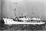 Eastward |
| Survey Equipment | Survey Info | Data Type(s) | Data Collected |
|---|---|---|---|
| Seismic reflection | --- | Air Gun / Water Gun Boomer Sparker | 1977-006-FA-SE-001 (microfilm of ) |
