Other ID: AST-80-6B
Status: Completed
Organization(s): USGS, Woods Hole Coastal and Marine Science Center
Funding Program(s):
Principal Investigator(s): Charles J. O'Hara
Affiliate Investigator(s):
Information Specialist(s):
Data Type(s): Seismics: Boomer, Seismics: Air Gun / Water Gun, Seismics: Bubble Gun, Seismics: Sparker, Location-Elevation: Navigation
Scientific Purpose/Goals: Define the acoustic stratigraphy and structure of Cox Ledge and determine the occurrence and seaward extent of large, deeply buried preglacial valleys cut into the submerged coastal plain rocks beneath this part of the inner continental shelf.
Vehicle(s):
Start Port/Location:
End Port/Location:
Start Date: 1980-06-10
End Date: 1980-06-12
Equipment Used: EG&G 234, Del Norte hydrophone, Northstar 6000 LORAN-C
Information to be Derived:
Summary of Activity and Data Gathered: Uniboom: 226 line km of high-resolution sub-bottom profiles (122 nautical miles).
Staff: Charles J. O'Hara
Affiliate Staff:
John Eusden
Geological Field Assistant; Anne Whitney
Geological Field Assistant
Notes: Original Center People field contained: Chuck O'Hara, Chief Scientist; John Eusden, Geological Field Assistant; Anne Whitney, Geological Field Assistant.
Location:
Cox Ledge, southern Rhode Island Sound, Martha's Vineyard, Muskeget Channel, Nantucket Sound, Massachusetts, United States, North America, North Atlantic;
| Boundaries | |||
|---|---|---|---|
| North: 41.33333 | South: 41.16667 | West: -71.5 | East: -70.5 |
Platform(s):
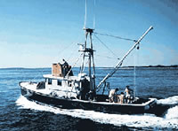
 Asterias |
McMullen, K.Y., Poppe, L.J., and Soderberg, N.K., 2009, Digital seismic-reflection data from eastern Rhode Island Sound and vicinity, 1975-1980: U.S. Geological Survey Open-File Report 2009-1003, 2 DVD-ROMs, URL: https://doi.org/10.3133/ofr20091003.
FAN 1980-012-FA has data viewable in the GeoMappApp/Virtual Ocean applications. To view this data in these applications go to http://www.geomapapp.org/ and http://www.virtualocean.org/. See the instructions for locating USGS data in these applications. You can also view the imagery created from the SEGY data at https://cmgds.marine.usgs.gov/images.php?cruise=1980-012-FA.
| Title | Survey Equipment | Description |
|---|---|---|
| Cruise report | (document not focused on specific equipment) | Chief Scientist's cruise report describing objectives, equipment and configuration, participants, data acquisition statistics, and track maps. |
| Uniboom log | EG&G 234 | Uniboom seismic log containing line numbers, start and end dates and times, Loran time delays, data acquisition notes, equipment performance. |
| Survey Equipment | Survey Info | Data Type(s) | Data Collected |
|---|---|---|---|
| EG&G 234 | --- | Boomer | |
| Del Norte hydrophone | --- | Air Gun / Water Gun Boomer Bubble Gun Sparker | 1980-012-FA-SE-002 (microfilm of ) 1980-012-FA-SE-001 ( Collection of paper record displays of seismic data( UNI) for lines ) 1980-012-FA-SE-003 (Raw SEGY formatted data) SEGY data |
| Northstar 6000 LORAN-C | --- | Navigation | 1980-012-FA-LN-001-01 (Track map for western half of survey.) 1980-012-FA-LN-001-02 (Track map for eastern half of survey.) 1980-012-FA-LN-001-04 (Track map for eastern half of survey. (different annotation)) 1980-012-FA-LN-001-03 (Track map for western half of survey. (different annotation)) Nav data |