Other ID: 97-6
Status: Completed
Organization(s): USGS, Woods Hole Coastal and Marine Science Center
Funding Program(s):
Principal Investigator(s): David Twichell
Affiliate Investigator(s): Hans Nelson - PMG
Information Specialist(s):
Data Type(s): Seismics: Multichannel, Imagery: Photo, Imagery: Video, Location-Elevation: Navigation, Sampling: Geology, Seismics: Air Gun / Water Gun, Seismics: Boomer, Seismics: Bubble Gun, Seismics: Sparker, Seismics: Sub Bottom Profiler, Sonar: Sidescan, Sonar: Single Beam
Scientific Purpose/Goals: A turbidity current pathway on the Louisiana slope was to be mapped with SIS-7000, seismic profiles, and piston cores to understand sand deposit formation. The study area was between 26 and 27.5 deg. N and 91 and 92 deg. W in water depths ranging from 800-2,800 m.
Vehicle(s):
Start Port/Location: Galveston, TX
End Port/Location: Galveston, TX
Start Date: 1997-04-05
End Date: 1997-04-25
Equipment Used: Multichannel seismics, SIS-7000 sidescan, ISIS, Odom Digitrace 200kHz, 3.5 kHz, Mudseis, DGPS, Piston corer, Digital camera, GI Air Gun
Information to be Derived:
Summary of Activity and Data Gathered:
Staff: VeeAnn Cross, William Danforth, David Foster, Eric Haase, Barry Irwin, David Nichols, Thomas O'Brien, Michael Taylor, David Twichell
Affiliate Staff:
Hans Nelson - co-chief scientist - PMG; Scott Harrison - St. Pete; Gita Dunhill - PMCT; Jed Damuth - UTArl; Marty Bohn
Eric Q. - TAMU coring; John Brand
Eddy Lee
Chris Spaquaolo - TAMU students
Notes: 4/5-15 Sidescan and seismics: Twichell - Ch Sci. 4/15-25. Piston coring: Twichell and Nelson - co-Ch Sci. A web page is in the process of being developed for this project, and we will update when it is on line.
Project = Tectonics and sedimentary processes of the salt, Tectonics and sedimentary processes of the salt
Information from Foghorn: DGPS and P-code GPS navigation, SIS7000 w/chirp sub-bottom, ISIS logger, acoustic ranging system, XSONAR;digital bathymetry, 3.5 kHz;GI gun, Mudseis; DGPS and P-code GPS for ship;
4/5-15 Sidescan and seismics: Twichell - Ch Sci. 4/15-25. Piston coring: Twichell and Nelson - co-Ch Sci
Location:
offshore Louisiana, United States, Gulf of America (Gulf of Mexico), North America, North Atlantic;
| Boundaries | |||
|---|---|---|---|
| North: 27.48769817 | South: 25.97560459 | West: -92.97512741 | East: -91.4997586 |
Platform(s):
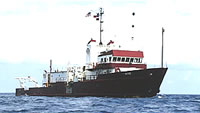
 Gyre |
Poore, R.Z., Dowsett, H.J., Verardo, S., Quinn, T.M., 2003, Millennial- to century-scale variability in Gulf of Mexico Holocene climate records: Paleoceanography, v. 18, pp. 26–1, doi: 10.1029/2002PA000868.
Nealon, J.W., Dillon, W.P., and Twichell, D.C., 1999, Seismic reflection results from the GYRE 1997 cruise of the Bryant Canyon on the Louisiana Gulf Coast: U.S. Geological Survey Open-File Report 99-449, 3 CD-ROMs, URL: https://doi.org/10.3133/ofr99449.
Twichell, D.C. Cross, V.A., Paskevich, V.F., Hutchinson, D.R., Winters, W.J., and Hart, P.E., 2006, GIS of selected geophysical and core data in the northern Gulf of Mexico continental slope collected by the U.S. Geological Survey: U.S. Geological Survey Open-File Report 2005-1071, DVD-ROM, also available from https://doi.org/10.3133/ofr20051071.
FAN 1997-006-FA has data viewable in the GeoMappApp/Virtual Ocean applications. To view this data in these applications go to http://www.geomapapp.org/ and http://www.virtualocean.org/. See the instructions for locating USGS data in these applications. You can also view the imagery created from the SEGY data at https://cmgds.marine.usgs.gov/images.php?cruise=1997-006-FA.
| Title | Survey Equipment | Description |
|---|---|---|
| Navigation log | DGPS | Cruise navigator's notes, Leg 1. Includes antenna and equipment configuration, time of start and end of lines and comments. |
| Navigation log | DGPS | Navigation printout for Legs 1 and 2 containing time, latitude, longitude, speed, direction, and sample event mark. |
| Geophysics log | (document not focused on specific equipment) | Seismic/geophysics log for Legs 1 and 2. Leg 1 is water gun, Leg 2 is 3.5 kHz and piston core locations. |
| Cruise log | (document not focused on specific equipment) | Chief Scientist's seismic/geophysics log for Leg 1 with system, julian day, time, line, storage device, and comments.. Includes systems documented in the log. |
| Core log | Piston corer | Chief Scientist's core log with position information, equipment, core recovery and section notes. From Leg 2. |
| Core description | Piston corer | Chief Scientist's visual core description log for Leg 2. |
| Survey Equipment | Survey Info | Data Type(s) | Data Collected |
|---|---|---|---|
| Multichannel seismics | --- | Multichannel | Air gun data |
| SIS-7000 sidescan | --- | Sidescan | |
| ISIS | --- | Sidescan | |
| Odom Digitrace 200kHz | --- | Single Beam | |
| 3.5 kHz | --- | Sub Bottom Profiler | 1997-006-FA-SE-001 ( Collection of paper record displays of seismic data( 3.5K) for lines ) |
| Mudseis | --- | Air Gun / Water Gun Boomer Bubble Gun Sparker | |
| DGPS | --- | Navigation | 1997-006-FA-LN-001 (Floppy disk(s) containing NAV DGPS, NAV DGPS, NAV DGPS, NAV DGPS, NAV DGPS, NAV DGPS, NAV DGPS, NAV DGPS PLGR BACKUP, ) 1997-006-FA-NL-001-02 (Navigation printout for Legs 1 and 2 containing time, latitude, longitude, speed, direction, and sample event mark.) Water gun navigation |
| Piston corer | --- | Geology | 1997-006-FA-NL-001-08 (Chief Scientist's visual core description log for Leg 2.
) 1997-006-FA-SC-001 (CORE samples) |
| Digital camera | --- | Photo | |
| GI Air Gun | --- | Air Gun / Water Gun |