Other ID: G199GM
Status: Completed
Organization(s): USGS, Woods Hole Coastal and Marine Science Center
Funding Program(s):
Principal Investigator(s): David Twichell
Affiliate Investigator(s): Alan Cooper, USGS, Menlo Park Dave Twichell
Information Specialist(s): Other
Data Type(s): Seismics: Sub Bottom Profiler, Location-Elevation: Navigation, Location-Elevation: Transects, Seismics: Boomer, Seismics: Multichannel, Sonar: Sidescan
Scientific Purpose/Goals: Collection of regional high-resolution multichannel seismic data and Huntec seismic data as well as two detailed sidescan surveys to understand the distribution of gas hydrates on the upper continental slope in the Gulf of America (Gulf of Mexico) and their effect on sea floor processes.
Vehicle(s):
Start Port/Location: Galveston, TX
End Port/Location: Galveston, TX
Start Date: 1999-04-09
End Date: 1999-04-22
Equipment Used: SIS1000 Chirp Sonar, SIS1000 Sidescan sonar, Multichannel seismics, Benthos 7000 , DGPS, Other, Boomer, Single channel hydrophone
Information to be Derived: Seismic images of the gas hydrate stability zone and near surface geologic hazards; side-scan images of the sea floor
Summary of Activity and Data Gathered: Not all the gear was run all the time, so the amounts of individual data types (in km) are as listed: High-resolution MCS data - 1400 km; Huntec boomer data - 900 km; SIS-1000 sidescan and Chirp sub-bottom data - 500 km.
Staff: William Danforth, David Foster, Barry Irwin, Thomas O'Brien
Affiliate Staff:
USGS
Menlo Park - Jeff Brody
watchstander; Pat Hart
seismic processor; Larry Kooker
electronics tech; Walt Olson
mechanical tech; Hal Williams
mechanical tech. Graham Standen - Geoforce
Inc.
Notes: seismic rolls at PCMSC G199GM
Scanned data on FAD; G199GM
Original Center People field contained: Chris Anton, watchstander; Bill Danforth, sidescan processing; Dave Foster, seismic processing; Barry Irwin, nav. tech.; Dave Nichols, electronics tech; Tom O'Brien, electronics tech.
Project = Gulf of America (Gulf of Mexico) Tectonics and Hydrates Projects, Gulf of America (Gulf of Mexico) Tectonics and Hydrates Projects
Location:
Gulf of America (Gulf of Mexico), United States, North America, North Atlantic;
| Boundaries | |||
|---|---|---|---|
| North: 28 | South: 27.5 | West: -93 | East: -91.25 |
Platform(s):
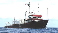
 Gyre |
Cooper, A.K., Twichell, D., and Hart, P., 1991, A seismic-reflection investigation of gas hydrates and sea-floor features of the upper continental slope of the Garden Banks and Green Canyon regions, northern Gulf of Mexico--Report for cruise GI-99-GM (99002): U.S. Geological Survey Open-File Report 99-570, https://doi.org/10.3133/ofr99570.
Foster, D.S., Twichell, D.C., Danforth, W.W., Irwin, B.J., Nichols, D.R., and O'Brien, T.F., 1999, Archive of SIS-1000 CHIRP subbottom data collected during USGS Cruise GYRE 99002, Gulf of Mexico, 9-22 April, 1999: U.S. Geological Survey Open-File Report 99-586, https://doi.org/10.3133/ofr99586.
Twichell, D.C. Cross, V.A., Paskevich, V.F., Hutchinson, D.R., Winters, W.J., and Hart, P.E., 2006, GIS of selected geophysical and core data in the northern Gulf of Mexico continental slope collected by the U.S. Geological Survey: U.S. Geological Survey Open-File Report 2005-1071, DVD-ROM, also available from https://doi.org/10.3133/ofr20051071.
FAN 1999-002-FA has data viewable in the GeoMappApp/Virtual Ocean applications. To view this data in these applications go to http://www.geomapapp.org/ and http://www.virtualocean.org/. See the instructions for locating USGS data in these applications. You can also view the imagery created from the SEGY data at https://cmgds.marine.usgs.gov/images.php?cruise=1999-002-FA.
| Title | Survey Equipment | Description |
|---|---|---|
| ISIS log | SIS1000 Sidescan sonar | ISIS system log of file and line changes, data collection notes. |
| Survey Equipment | Survey Info | Data Type(s) | Data Collected |
|---|---|---|---|
| SIS1000 Chirp Sonar | --- | Sub Bottom Profiler | Chirp seismic data |
| SIS1000 Sidescan sonar | --- | Sidescan | Sidescan mosaic |
| Multichannel seismics | --- | Multichannel | 1999-002-FA-SE-001 (Raw SEGY data) paper records (PCMSC data holdings) |
| Benthos 7000 | --- | Navigation Transects | |
| DGPS | --- | Navigation | |
| Other | --- | --- | --- |
| Boomer | --- | Boomer | |
| Single channel hydrophone | --- | Air Gun / Water Gun Boomer Bubble Gun Sparker Sub Bottom Profiler |