Other ID: R-16-08-MW
Status: Completed
Organization(s): USGS, Woods Hole Coastal and Marine Science Center
Funding Program(s):
Principal Investigator(s): David Foster
Affiliate Investigator(s): U.S. Army Corps of Engineers, IJC
Information Specialist(s): David Foster
Data Type(s): Biological Field Study: Experiments (biological), Biological Field Study: Surveys (biological), Imagery: Photo, Imagery: Video, Location-Elevation: Navigation, Sampling: Biology, Sampling: Geology, Seismics: Sub Bottom Profiler, Sonar: Interferometric, Sonar: Multibeam, Sonar: Sidescan, Visual Identification: Species ID, Sonar: Single Beam
Scientific Purpose/Goals: WHSC/SFMG will map the geologic framework of the upper St. Clair River and surficial geology of the river/lake bed. Stratigraphic mapping will include depth to bedrock and the stratigraphy of Quaternary glacial and post glacial deposits. Surficial mapping will delineate sediment texture and morphology of the river/lake bed. The geologic framework will support ongoing studies that are quantifying changes in river bed elevation, specifically, identifying the extent of river bed erosion. Geophysical systems will be deployed to acoustically image the geologic framework. Video, photography and sampling of the river bed will be used to verify the surficial geologic interpretation.
Vehicle(s):
Start Port/Location: Port Huron, MI
End Port/Location: Port Huron, MI
Start Date: 2008-05-29
End Date: 2008-06-02
Equipment Used: Digital camera, Klein 3000, DGPS, SeaBOSS, Echosounder, 3.5 kHz, Knudsen CHIRP Sub-bottom Profiler, SEA SWATHplus-M 234 kHz
Information to be Derived: Samples and chemical analysis; Sea floor map; Bathymetric maps; Morphology;
Summary of Activity and Data Gathered: Data were collected over a five day period. Data include seismic reflection profiles: 79.8 km of 3.5 kHz Chirp data recorded in SEG-Y format, 58.5 km of Boomer seismic reflection profiles recorded in SEG-Y format, 79.8 km of Submetrix bathymetric data, 79.8 km of Klein sidescan sonar data in XTF format, 453 digital bottom photographs in JPEG format, 310 minutes of bottom video, and 17 bottom sediment samples.
Staff: Jane Denny, David Foster, Barry Irwin, Charles Worley
Affiliate Staff:
Greg Kennedy
USGS-Ann Arbor
Observer; Peter Ashmore
Univ. of Western Ontario
Observer
Notes: Original Center People field contained: Jane Denny - Data processing, GIS and integration; Dave Foster - Scientist, data processing; Barry Irwin - Boat operation, navigation; Chuck Worley - Technician.
Project = Marine Technology: St. Clair River Geophysical Survey, Marine Technology: St. Clair River Geophysical Survey
Location:
St. Clair River, Lake Huron, Michigan, Ontario, United States, Canada, North America;
| Boundaries | |||
|---|---|---|---|
| North: 43.01700416 | South: 42.65292746 | West: -82.51594507 | East: -82.40005636 |
Platform(s):
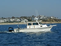
 Rafael |
Denny, J.F., Foster, D.S., Worley, C.R., and Irwin, B.J., 2011, Geophysical data collected from the St. Clair River between Michigan and Ontario, Canada (2008-016-FA): U.S. Geological Survey Open-File Report 2010–1035, 16 p., at https://doi.org/10.3133/ofr20101035.
Foster, David S., and Denny, Jane F., 2009, Quaternary geologic framework of the St. Clair River between Michigan and Ontario, Canada: U.S. Geological Survey Open-File Report 2009-1137, available online at https://doi.org/10.3133/ofr20091137.
FAN 2008-016-FA has data viewable in the GeoMappApp/Virtual Ocean applications. To view this data in these applications go to http://www.geomapapp.org/ and http://www.virtualocean.org/. See the instructions for locating USGS data in these applications. You can also view the imagery created from the SEGY data at https://cmgds.marine.usgs.gov/images.php?cruise=2008-016-FA.
| Survey Equipment | Survey Info | Data Type(s) | Data Collected |
|---|---|---|---|
| Digital camera | --- | Photo | |
| Klein 3000 | --- | Sidescan | Sidescan mosaic |
| DGPS | --- | Navigation | |
| SeaBOSS | --- | Surveys (biological) Experiments (biological) Species ID Photo Video Geology Biology | 2008-016-FA-SC-001 (17 bottom sediment samples) |
| Echosounder | --- | Single Beam | |
| 3.5 kHz | --- | Sub Bottom Profiler | |
| Knudsen CHIRP Sub-bottom Profiler | Knudsen 3200 | Sub Bottom Profiler | 2008-016-FA-SE-002-01 (SioSeis was used to apply a bandpass filter of 500-2000 Hz and an AGC with a window of 20 ms before writing to SEG-Y files.) Chirp seismic data 2008-016-FA-SE-001-01 (SIOSeis was used to apply a 1-2-1 trace mix and t square gain (Sioseis type 3, alpa 1.75) before writing ieee floating point SEG-Y files.) Boomer seismic data |
| SEA SWATHplus-M 234 kHz | --- | Interferometric | Bathymetry GIS data |