Other ID: none
Status: Completed
Organization(s): USGS, Woods Hole Coastal and Marine Science Center
Funding Program(s):
Principal Investigator(s): Uri Ten Brink
Affiliate Investigator(s): Jason Chaytor, USGS-WHSC, Dwight Coleman, URI, Amanda Demopoulos, USGS-SESC
Information Specialist(s): Brian Andrews, Jason Chaytor
Data Type(s): Sampling: Geology, Sonar: Multibeam, Sonar: Single Beam
Scientific Purpose/Goals: tectonics and landslide activity in the NE Caribbean.
Vehicle(s):
Start Port/Location: San Juan, PR
End Port/Location: San Juan, PR
Start Date: 2013-10-02
End Date: 2013-10-18
Equipment Used: EM 302 , Grab sampler, Echosounder
Information to be Derived: Grain size analysis;Sea floor map;Morphology;
Summary of Activity and Data Gathered: Collected 2,028 kms of multbeam data to fill in data gaps in existing bathymetry coverage of area. Completed 10 ROV dives
Staff: Brian Andrews, William Danforth
Affiliate Staff:
Ocean Exploration Trust ship and shore personnel
Two scientists from the University of Puerto Rico
Notes: Project = Marine Geohazards/Source Eval,
Location:
Puerto Rico, the Virgin Islands, and the Dominican Republic, northeast Caribbean, North Atlantic;,
| Boundaries | |||
|---|---|---|---|
| North: 20 | South: 17 | West: -70 | East: -63 |
Platform(s):
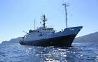 Nautilus |
| Survey Equipment | Survey Info | Data Type(s) | Data Collected |
|---|---|---|---|
| EM 302 | --- | Multibeam | |
| Grab sampler | --- | Biology Geology | |
| Echosounder | --- | Single Beam |
