Other ID: 14BIM05
Status: Completed
Organization(s): Other, USGS, St. Petersburg Coastal and Marine Science Center
Funding Program(s): Other (Other)
Principal Investigator(s): James Flocks, Jennifer Miselis
Affiliate Investigator(s):
Information Specialist(s): Julie Bernier, Arnell Forde, Kyle Kelso
Data Type(s): Electro-Magnetic: Magnetics, Location-Elevation: Navigation, Seismics: Sub Bottom Profiler, Sonar: Interferometric, Sonar: Sidescan, Sonar: Sound Velocity
Scientific Purpose/Goals: Characterize the geologic framework
Vehicle(s): Excursion - White, Ford F-350 Dually White (GSA), Ford F-350 Dually - Silver (GSA), White Dodge Pickup - White
Start Port/Location: Venice, La
End Port/Location: Biloxi, Ms
Start Date: 2014-08-11
End Date: 2014-08-31
Equipment Used: Geometrics G-882 (Cesium) Marine Magnetometer, F190 DGPS/IMU, Chirp 512i, Klein Side Scan, Interferometric Bathymetry System, Valeport SVP, Ashtech Z-Xtreme DGPS, Other
Information to be Derived: Bathymetry, nearsurface geology, and island elevation.
Summary of Activity and Data Gathered: Collected side scan sonar, sub-bottom profile (93 lines), magnetometer, and swath bathymetry (76 lines) data.
Staff: James Flocks, Joseph Fredericks, Kyle Kelso, Jack Kindinger, Stanley Locker
Affiliate Staff:
Notes: Entries for this field activity are based on entries from Field Activity 2014-314-FA
Location:
Breton Island, Chandeleur Islands, Louisiana, Gulf of Mexico
| Boundaries | |||
|---|---|---|---|
| North: 29.57913024 | South: 29.36320932 | West: -89.2886 | East: -89.03729248 |
Platform(s):
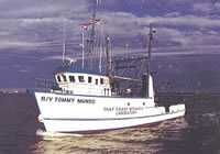 Tommy Munro |
DeWitt, N.T., Fredericks, J.J., Flocks, J.G., Miselis, J.L., Locker, S.D., Kindinger, J.G., Bernier, J.C., Kelso, K.W., Reynolds, B.J., Wiese, D.S., Browning, T., 2016, Archive of bathymetry and backscatter data collected in 2014 nearshore Breton and Gosier Islands, Breton National Wildlife Refuge, Louisiana: U.S. Geological Survey Data Series 1005, https://doi.org/10.3133/ds1005.
Flocks, J., Kindinger, J., Miselis, J., Locker, S., 2015, Stratigraphy And Morphology Of The Barrier Platform Of Breton Island, Louisiana: Deltaic, Marine And Human Influences: Coastal Sediments 2015World Scientific, , doi: 10.1142/9789814689977_0194.
Flocks, J.G., Terrano, J.F., 2016, Analysis of seafloor change at Breton Island, Gosier Shoals, and surrounding waters, 1869-2014, Breton National Wildlife Refuge, Louisiana: U.S. Geological Survey Open-File Report 2016-1069, 34 p., https://doi.org/10.3133/ofr20161069.
Terrano, J.F., Flocks, J.G., Smith, K.E.L., 2016, Analysis of shoreline and geomorphic change for Breton Island, Louisiana, from 1869 to 2014: U.S. Geological Survey Open-File Report 2016-1039, 43 p., https://doi.org/10.3133/ofr20161039.
| Survey Equipment | Survey Info | Data Type(s) | Data Collected |
|---|---|---|---|
| Geometrics G-882 (Cesium) Marine Magnetometer | --- | Magnetics | |
| F190 DGPS/IMU | --- | Navigation | 14BIM05_IFB_tracklines.zip (Swath tracklines – R/V Tommy Munro) |
| Chirp 512i | --- | Sub Bottom Profiler | DS 972 SEGY (Raw chirp SEGY data) |
| Klein Side Scan | --- | Sidescan | 14BIM05_SSS_50cm_WGS84_UTM16N_Tile (Sidescan Sonar Mosaic 0.50-m resolution) |
| Interferometric Bathymetry System | --- | Interferometric | 14BIM05_IFB_xyz.zip (Swath data 5-m BASE resolution – R/V Tommy Munro) |
| Valeport SVP | --- | Sound Velocity | |
| Ashtech Z-Xtreme DGPS | --- | Benchmarks Navigation | |
| Other | --- | --- | --- |
