Other ID: MATRIX
Status: Completed
Organization(s): USGS, Woods Hole Coastal and Marine Science Center
Funding Program(s): USGS GAS HYDRATES (LQ000FP)
Principal Investigator(s): Carolyn Ruppel
Affiliate Investigator(s):
Information Specialist(s): Nathaniel Miller, Carolyn Ruppel
Data Type(s): Seismics: Multichannel, Location-Elevation: Navigation, Seismics: Air Gun / Water Gun, Seismics: Sonobuoy, Sonar: Water column reflectivity, Sonar: Multibeam
Scientific Purpose/Goals: Acquire over 2000 line-km of MCS data with 210 in^3 GI-guns and sonobuoys (for long offsets) in the data gap for modern seismics on this margin; EK60/80 data
Vehicle(s):
Start Port/Location: Lewes, DE
End Port/Location: Lewes, DE
Start Date: 2018-08-08
End Date: 2018-08-28
Equipment Used: Simrad EK80, GI Air Gun, WAAS/DGPS, Expendable seismic sonobuoys, GeoEel digital streamer
Information to be Derived: gas hydrate distribution, geohazards
Summary of Activity and Data Gathered: Acquired just over 2000 line kilometers of multichannel seismic data between Hudson Canyon and Cape Hatteras, mostly using four 105/105 Sercel GI guns operated at 105 cubic inches volume and towed on 2 strings of two guns each as the source. The streamer of receivers was over 1 km long for most of the cruise, and most data were acquired between the shelf break and ~2500 m water depth. Seismic data were acquired both on dip lines and strike lines (deepwater and top of slope). Sonobuoys were deployed at 60 locations at water depths greater than 1000 m along the MCS survey lines. The EK80 with a 38 kHz transducer was operated continuously during the cruise to image water column methane bubbles. Ship's sensor and ADCP data available at: https://www.rvdata.us/search/cruise/HRS1807 Environmental compliance: Incidental Harassment Authorization (IHA) acquired for Marine Mammal Protection Act compliance; Biological Opinion issued by NMFS Office of Protected Resources for Endangered Species Act compliance. Miscellaneous consultations related to essential fish habitat, seabirds, etc. Finding of No Significant Impact issued by the USGS.
Staff: Jennifer McKee, Daniel Powers, Peter Dal Ferro, Wayne Baldwin, Emile Bergeron, David Foster, Eric Moore, Alexander Nichols
Affiliate Staff:
Notes: Nathan Miller co PI
Large amount of equipment being borrowed from Scripps
Project will require an IHA from NMFS (MMPA) and a biological opinion from OPR (ESA). IHA is expected on 6 August 2018
Location:
Mid-Atlantic margin, 35 nm south of Hudson Canyon to approximately Cape Hatteras, 100 m to 3500 m water depth
| Boundaries | |||
|---|---|---|---|
| North: 39.24927085 | South: 34.52466147 | West: -75.21240234 | East: -70.6640625 |
Platform(s):
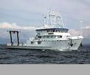 Hugh R. Sharp |
Baldwin, W.E., Bergeron, E.M., Foster, D.S., Moore, E.M., Nichols, A.R., O'Brien, T.F., Miller, N.C., and Ruppel, C.D., 2021, Split-beam echo sounder and navigation data collected using a Simrad EK80 wide band transceiver and ES38-10 transducer during the Mid-Atlantic Resource Imaging Experiment (MATRIX), USGS field activity 2018-002-FA: U.S. Geological Survey data release, https://doi.org/10.5066/P948VJ4X.
Baldwin, W. E., Foster, D. S., Bergeron, E. M., Dal Ferro, P., McKee, J. A., Moore, E. M., Nichols, A. R., O'Brien, T. F., Powers, D., Miller, N. C., and Ruppel, C. D., 2020, Multichannel seismic-reflection and navigation data collected using Sercel GI guns and Geometrics GeoEel digital streamers during the Mid-Atlantic Resource Imaging Experiment (MATRIX), USGS field activity 2018-002-FA: U.S. Geological Survey data release, https://doi.org/10.5066/P91WP1RZ.
Baldwin, W.E., Foster, D.S., Bergeron, E.M., Dal Ferro, P., McKee, J.A., Moore, E.M., Nichols, A.R., O'Brien, T.F., Powers, D., Miller, N.C., and Ruppel, C.D., 2021, Sonobuoy seismic and navigation data collected using Sercel GI guns and Ultra Electronics expendable sonobuoys during the Mid-Atlantic Resource Imaging Experiment (MATRIX), USGS Field Activity 2018-002-FA: U.S. Geological Survey data release, https://doi.org/10.5066/P97LBUSP.
Majumdar, U., N.C. Miller, and C.D. Ruppel, 2022, Neural network mapping of seismic features related to gas hydrates and free gas accumulations on the Northern U.S. Atlantic Margin, Interpretation, 10, T785-T806, http://dx.doi.org/10.1190/INT-2021-0248.1.
Ruppel, C., Baldwin, W., Miller, N.C., 2024, Modeling constraints on geologic, oceanographic, and climate change processes responsible for multiple generations of bottom simulating reflections observed on the U.S. Atlantic Margin: , AGU Fall Meeting 2024. URL: https://agu.confex.com/agu/agu24/meetingapp.cgi/Paper/1554172.
Ruppel, C., Skarke, A., Miller, N., Kidiwela, M., Kluesner, J., Baldwin, W., 2024, Methane seeps on the U.S. Atlantic margin: An updated inventory and interpretative framework, Marine Geology, Volume 471, 107287, ISSN 0025-3227, https://doi.org/10.1016/j.margeo.2024.107287.
Ruppel, C.D., Miller, N.C., Baldwin, W., Frye, M., Shedd, W., Hutchinson, D., 2024, Thermal state of the U.S. Atlantic Rifted Margin: , AGU Fall Meeting 2024. URL: https://agu.confex.com/agu/agu24/meetingapp.cgi/Paper/1548859.
| Title | Survey Equipment | Description |
|---|---|---|
| 2018-002-FA_StreamerConfig_InfoLogs.pdf | GeoEel digital streamer | PDF formatted MCS streamer configuration diagrams and information logs. |
| Survey Equipment | Survey Info | Data Type(s) | Data Collected |
|---|---|---|---|
| Simrad EK80 | --- | Water column reflectivity Multibeam | 2018-002-FA_EK80 (Split-beam echo sounder and navigation data collected using a Simrad EK80 wide band tranceiver and ES38-10 transducer during the Mid-Atlantic Resource Imaging Experiment (MATRIX), USGS Field Activity 2018-002-FA) |
| GI Air Gun | Used up to four Sercel 105/105 cubic inch generator-injector (GI) airguns. | Air Gun / Water Gun | |
| WAAS/DGPS | --- | Navigation | |
| Expendable seismic sonobuoys | Ultra Electronics Maritime Systems Inc. expendable seismic sonobuoys models AN/SSQ-53D(3) and AN/SSQ-53G | Sonobuoy | 2018-002-FA_SB (Sonobuoy seismic and navigation data collected using Sercel GI guns and Ultra Electronics seismic sonobuoys during the Mid-Atlantic Resource Imaging Experiment (MATRIX), USGS Field Activity 2018-002-FA) |
| GeoEel digital streamer | Streamer composed of both solid state and oil-filled active sections of 50 and 100 m lengths (6.25 or 12.5 m groups, respectively) configured in active sections equalling 700 -1200 meters long. | Boomer Multichannel Sparker Air Gun / Water Gun Bubble Gun | 2018-002-FA_MCS (Multichannel seismic-reflection and navigation data collected using Sercel GI guns and Geometrics GeoEel Digital Streamers during the Mid-Atlantic Resource Imaging Experiment (MATRIX), USGS Field Activity 2018-002-FA) |
