Other ID: none
Status: Completed
Organization(s): USGS, Woods Hole Coastal and Marine Science Center
Funding Program(s): National Seafloor Mapping and Benthic Habitat Studies: Atlantic (LQ000FO)
Principal Investigator(s): Page Valentine
Affiliate Investigator(s): Dr. David Wylie, SBNMS
Information Specialist(s): Dann Blackwood
Data Type(s): Environmental Data: CTD, Environmental Data: Turbidity, Environmental Data: Fluorescence, Imagery: Photo, Imagery: Video, Location-Elevation: Navigation, Sampling: Geology
Scientific Purpose/Goals: Collect seabed sediment samples for geological mapping project
Vehicle(s):
Start Port/Location: Scituate, MA
End Port/Location: Scituate, MA
Start Date: 2019-07-26
End Date: 2019-08-03
Equipment Used: SBE 19plus V2 SeaCAT Profiler CTD, Nikon 7100 digital camera, SeaBOSS, Furuno satellite compass SC-30, GoPro camera
Information to be Derived: Sediment samples for geological mapping
Summary of Activity and Data Gathered: See 2019-008-FA for details.
Staff: Dann Blackwood
Affiliate Staff:
Notes: Travel to and from Scituate, MA for day-cruises to Stellwagen Bank.
CTD required as for previous cruises.
Load Auk in Scituate, MA
Location:
Stellwagen Bank NMS
| Boundaries | |||
|---|---|---|---|
| North: 42.43291733 | South: 42.15774908 | West: -70.47317505 | East: -70.10467595 |
Platform(s):
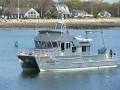 Auk |
Valentine, P.C., and Cross, V.A., 2026, Seabed maps showing topography, ruggedness, backscatter intensity, sediment mobility, and the distribution of geologic substrates in quadrangle 3 of the Stellwagen Bank National Marine Sanctuary region offshore of Boston, Massachusetts: U.S. Geological Survey Scientific Investigations Map 3544, 8 sheets, scale 1:25,000, 30-p. pamphlet, https://doi.org/10.3133/sim3544.
Valentine, P.C., and Cross, V.A., 2024, Geospatial datasets of seabed topography, sediment mobility, and the distribution of geologic substrates in quadrangle 2 of the Stellwagen Bank National Marine Sanctuary region offshore of Boston, Massachusetts: U.S. Geological Survey data release, https://doi.org/10.5066/P9UL3LWN.
Valentine, P.C., and Cross, V.A., 2026, Geospatial datasets of seabed topography, sediment mobility, and the distribution of geologic substrates in quadrangle 3 of the Stellwagen Bank National Marine Sanctuary region offshore of Boston, Massachusetts: U.S. Geological Survey data release, https://doi.org/10.5066/P13PVHRI.
Valentine, P.C., and Cross, V.A., 2023, Geospatial datasets of seabed topography, sediment mobility, and the distribution of geologic substrates in quadrangle 5 of the Stellwagen Bank National Marine Sanctuary region offshore of Boston, Massachusetts: U.S. Geological Survey data release, https://doi.org/10.5066/P9W9BN3S.
Valentine, P.C., and Cross, V.A., 2020, Sea-floor sediment samples, seabed imagery, and CTD instrument data collected on Stellwagen Bank in July and August, 2019, U.S. Geological Survey Field Activity 2019-008-FA (ver. 1.1, May 2023): U.S. Geological Survey data release, https://doi.org/10.5066/P93ATKSC.
| Title | Survey Equipment | Description |
|---|---|---|
| Cruise log | (document not focused on specific equipment) | Acquisition and observation logs for seabed video and sediment samples collected aboard the R/V Auk on Stellwagen Bank. |
| Survey Equipment | Survey Info | Data Type(s) | Data Collected |
|---|---|---|---|
| SBE 19plus V2 SeaCAT Profiler CTD | In addition to the CTD water column profiling, the CTD is equipped with auxiliary sensors to measure fluorescence and turbidity. The instrument was mounted on the SEABOSS frame. | CTD Fluorescence Turbidity | 2019-008-FA_CTD (Conductivity-temperature-depth, fluorescence and turbidity data collected aboard the R/V Auk on Stellwagen Bank (text files).) |
| Nikon 7100 digital camera | Images were taken of the surface of the grab samples while still in the grab sampler. | Photo | 2019-008-FA_SampleImages (Grab sample still images collected aboard the R/V Auk on Stellwagen Bank (JPEG image format. EXIF headers have been added to include navigation and other meta tags).) |
| SeaBOSS | The SEABed Observation and Sampling System (SEABOSS) was used to collect sediment samples with a modified Van Veen sampler and video images of the seabed with GoPro cameras mounted on the frame. A CTD was mounted horizontally on the SEABOSS frame. | Surveys (biological) Experiments (biological) Species ID Photo Video Geology Biology | 2019-008-FA_station_summary (Station and data summary for data collected aboard the R/V Auk on Stellwagen Bank (Geographic, WGS 84, point shapefile, XLSX and CSV formats)) 2019-008-FA_sedsamples (Location and analyses of sediment samples collected aboard the R/V Auk on Stellwagen Bank (Geographic, WGS 84, point shapefile, XLSX and CSV formats).) |
| Furuno satellite compass SC-30 | The location information for stations was acquired from a satellite navigation receiver (Furuno satellite compass SC-30, GPS receiver) at two second intervals. | Navigation | 2019-008-FA_nav (Navigation data collectd aboard the R/V Auk on Stellwagen Bank (Geographic, WGS 84, XLSX and CSV formats).) |
| GoPro camera | Seabed video images were collected using a GoPro digital video camera mounted on SEABOSS to provide ground-truth information for geophysical datasets and are used in seabed interpretations. Frame-grab images were extracted from the video. | Photo Video | 2019-008-FA_SeabedImages (Seabed still images collected aboard the R/V Auk on Stellwagen Bank (JPEG image format. EXIF headers have been added to include navigation and other meta tags).) 2019-008-FA_video_driftlines (Video transects of the sea floor collected aboard the R/V Auk on Stellwagen Bank (Geographic, WGS 84, polyline shapefile format).) |
