AKA: none
Other ID: none
Status: Completed
Organization(s): USGS, Pacific Coastal and Marine Science Center
Funding Program(s): Coastal and marine earthquake, tsunami, and landslide active margin field studies (ZP00EQV)
Principal Investigator(s): Jenna Hill
Affiliate Investigator(s):
Information Specialist(s): Alicia Balster-gee
Data Type(s): Sampling: Geology, Seismics: Sparker, Seismics: Sub Bottom Profiler
Scientific Purpose/Goals: To collect sediment cores for marine geohazard studies
Vehicle(s): MarFac; Ford 650 Box truck - White G71-03559
Start Port/Location: San Francisco, CA
End Port/Location: San Francisco, CA
Start Date: 2019-09-27
End Date: 2019-10-10
Equipment Used: pistoncore, 512 chirp-source, Other, 512 chirp, Mini sparker, Gravity Core, 48-channel streamer
Information to be Derived: Sediment age, character and distribution; fault characterization
Summary of Activity and Data Gathered: Collected 36 piston cores, 2 gravity cores, 41 minisparker multichannel seismic profiles, and 100 chirp line segments that make up 42 total chirp profiles.
Staff: Daniel Brothers, Peter Dal Ferro, Gerry Hatcher, Jenna Hill, Jennifer McKee, Janet Watt
Affiliate Staff:
Notes:
Location:
Northern California, Southern Oregon, United States, Pacific Ocean
| Boundaries | |||
|---|---|---|---|
| North: 41.76311745 | South: 40.2854841 | West: -125.25388241 | East: -124.07787323 |
Platform(s):
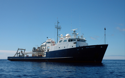 Bold Horizon |
Balster-Gee, A.F., Hill, J.C., Watt, J.T., Brothers, D.S., Nieminski, N.M., Alongi, T., Hatcher, G.A., and Nasr, B.M., 2023, Multichannel minisparker seismicreflection and chirp subbottom data collected offshore Northern California during USGS field activity 2019-643-FA: U.S. Geological Survey , https://doi.org/10.5066/P998EC72.
Hill, J.C., Nieminski, N.M., La Selle, S.M., W., J.W., Brothers, D.S., McGann, M.L., Alongi, T.V., Hatcher, G.A., Nasr, B.M., McKee, J.A., and Dal Ferro, P., 2024, Sediment core data from offshore southern Cascadia during field activity 2019-643-FA: U.S. Geological Survey , https://doi.org/10.5066/P1E8GDZH.
| Survey Equipment | Survey Info | Data Type(s) | Data Collected |
|---|---|---|---|
| pistoncore | --- | Geology | |
| 512 chirp-source | --- | Sub Bottom Profiler | |
| Other | --- | --- | --- |
| 512 chirp | --- | Sub Bottom Profiler | Chirp sub-bottom data (Chirp sub-bottom data were collected by the U.S. Geological Survey in 2019 offshore Humboldt County of northern California to expand data coverage along the southern Cascadia Margin.) |
| Mini sparker | --- | Sparker | |
| Gravity Core | --- | Geology | |
| 48-channel streamer | --- | Sparker | Multichannel minisparker seismic-reflection data (High-resolution multichannel seismic (MCS) data were collected by the U.S. Geological Survey in 2019 offshore Humboldt County of northern California to expand data coverage along the southern Cascadia Margin.) |
