Other ID: Pea Island Naitonal Wildlife Refuge Topobathy Survey - Post DUNEX
Status: Pending
Organization(s): USGS, Woods Hole Coastal and Marine Science Center, Woods Hole Oceanographic Institution
Funding Program(s): Remote Sensing Coastal Change (ZP00GJA)
Principal Investigator(s): Christopher Sherwood
Affiliate Investigator(s): Peter Traykovski: Woods Hole Oceanographic Institute
Information Specialist(s): Jin-Si Over
Data Type(s): Location-Elevation: Navigation, Sonar: Single Beam
Scientific Purpose/Goals: Collect topographic and bathymetric data of the Pea Island National Wildlife Refuge DUNEX site as a follow-up to the data collected in 2020-024-DD, 2021-028-FA, and 2021-029-FA.
Vehicle(s):
Start Port/Location: Pea Island National Wildlife Refuge, North Carolina
End Port/Location: Pea Island National Wildlife Refuge, North Carolina
Start Date: 2022-04-10
End Date: 2022-04-10
Equipment Used: PPK GPS, Cerulean Sonar S-500 Sounder
Information to be Derived: elevation/bathymetry
Summary of Activity and Data Gathered: Walking survey with PPK GPS and single-beam echo-sounder bathymetry collected using Yellowfin completed on April 10, 2022.
Staff:
Affiliate Staff:
Notes: Only P. Traykovski will be in the field. Chris Sherwood is on the permitting and data processing.
Account is: GX22.LQ00.GJEAF
Location:
Dare County, North Carolina, Cape Hatteras National Seashore - Pea Island National Wildlife Refuge
| Boundaries | |||
|---|---|---|---|
| North: 35.78439883 | South: 35.6264936 | West: -75.560669 | East: -75.4486084 |
Platform(s):
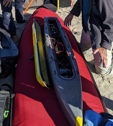 WHOI Yellowfin |  on foot |
| Survey Equipment | Survey Info | Data Type(s) | Data Collected |
|---|---|---|---|
| PPK GPS | PPK GPS attached to Yellowfin for bathymetry trackline data. PPK GPS also used to collect walking survey points for topography on beach and dune. | Navigation | |
| Cerulean Sonar S-500 Sounder | Single-beam echo sounder data collected using Yellowfin as platform | Single Beam |
