Other ID: MRDF
Status: Completed
Organization(s): USGS, Woods Hole Coastal and Marine Science Center
Funding Program(s): Marine Geohazards Sources and Probability (LQ00ENR)
Principal Investigator(s): Jason Chaytor
Affiliate Investigator(s): Melanie Damour (BOEM)
Information Specialist(s): Wayne Baldwin, David Foster, Brian Andrews
Data Type(s): Sampling: Geology, Sonar: Multibeam, Seismics: Boomer, Seismics: Sub Bottom Profiler, Seismics: Multichannel, Sonar: Sound Velocity, Environmental Data: Depth
Scientific Purpose/Goals: Geophysical mapping of the Mississippi Delta River Front
Vehicle(s):
Start Port/Location: Cocodrie, LA
End Port/Location: Cocodrie, LA
Start Date: 2023-09-01
End Date: 2023-09-30
Equipment Used: Reson T20-P, S-Boom seismic source, Edgetech chirp subbottom profiler 512i, GeoEel digital streamer, AML MVP30, RBRsolo-D depth logger
Information to be Derived: Bathymetry, backscatter, seismic reflection
Summary of Activity and Data Gathered: Collected 4,277 linear kilometers of Dual-head Reson T20P multibeam bathymetry, 3,623 kms of EdgeTech 512i seisemic reflection, and 3,325 kms of Geoeel multi channel seismic reflection data covering approximately 738 square kms in depths from 16 to 413 meters during 26 days of 24-hour operations.
Staff: Andrew Farmer, Laura Brothers, Chelsea Stalk, Alexander Nichols, Patrick Berube, Charles Worley, Brian Andrews, Wayne Baldwin, Seth Ackerman, David Foster, Eric Moore
Affiliate Staff:
Notes: Leg 1: Sept 3-18,Chaytor, Andrews, Baldwin, Worley, Danforth, Moore, Foster, Stalk (SPCMSC)
Leg 2: Sept 18-30, Brothers, Worley, Ackerman, Berube, Foster, Nichols, Farmer (SPCMSC), Damour (BOEM)
Location:
Mississippi River Delta Front, Gulf of America (Gulf of Mexico)
| Boundaries | |||
|---|---|---|---|
| North: 29.25179231 | South: 28.75688371 | West: -89.56162834 | East: -88.77113049 |
Platform(s):
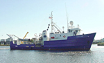 Pelican |
Damour, M., Chaytor, J., Jones, D., Brennan, M., Bentley, S., 2024, Shipwreck Sentinels: A Novel Approach for Monitoring Subsea Mudflows on the Mississippi River Delta Front: , Ocean Sciences Meeting 2024.
| Survey Equipment | Survey Info | Data Type(s) | Data Collected |
|---|---|---|---|
| Reson T20-P | --- | Multibeam Water column reflectivity | |
| S-Boom seismic source | --- | Boomer | |
| Edgetech chirp subbottom profiler 512i | --- | Sub Bottom Profiler | |
| GeoEel digital streamer | --- | Boomer Multichannel Sparker Air Gun / Water Gun Bubble Gun | |
| AML MVP30 | --- | Sound Velocity | |
| RBRsolo-D depth logger | --- | Depth |
