Other ID: MGL2314; Puerto Rico Seismic Surveys
Status: Pending
Organization(s): USGS, Woods Hole Coastal and Marine Science Center
Funding Program(s): Subduction Zone Marine GeoHaz (LQ00ENR10)
Principal Investigator(s): Uri Ten Brink
Affiliate Investigator(s):
Information Specialist(s): Wayne Baldwin
Data Type(s): Electro-Magnetic: Gravity, Electro-Magnetic: Magnetics, Location-Elevation: Navigation, Seismics: Sub Bottom Profiler, Sonar: Multibeam, Seismics: Air Gun / Water Gun, Seismics: Ocean Bottom Seismometer, Seismics: Multichannel
Scientific Purpose/Goals: Active source seismic reflection/refraction program designed to improve understanding of the Puerto Rico subduction zone and its associated hazards.
Vehicle(s):
Start Port/Location: San Juan, Puerto Rico
End Port/Location: Port Canaveral, FL
Start Date: 2023-10-27
End Date: 2023-12-19
Equipment Used: Knudsen 3260, Ocean Bottom Seismometer, Air gun, Multichannel seismics, EM122 12 kHz multibeam
Information to be Derived: Seismic reflection and refraction images of subduction zone, P- and S-wave velocity and density structure.
Summary of Activity and Data Gathered: Collected 2,606-line kilometers of multichannel seismic reflection profiles, 4,076-line kilometers of Knudsen 3260 Chirp sub-bottom profiles, 3,957 line-kilometers of Kongsberg EM122 MBES bathymetry, as well as underway navigation, gravity, magnetics, ADCP, and XBT data during first 26 survey days. Over the following 30 days, 41 OBS were deployed in segments along three roughly shore normal transects, two north (central and eastern) and one south (central) of Puerto Rico.
Staff: Charles Worley, Eric Moore, David Foster, Patrick Berube, Wayne Baldwin, Seth Ackerman
Affiliate Staff:
Heller
Samuel J - USGS Central Energy Resources Science Center
Notes:
Location:
Guayanilla Canyon, Southwest Puerto Rico; Puerto Rico Trench; Los Muertos Trough
| Boundaries | |||
|---|---|---|---|
| North: 20.9003 | South: 16.9378 | West: -68.2056 | East: -63.6429 |
Platform(s):
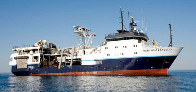
 Marcus G. Langseth |
Over, J., Ackerman, S., Cramer, J., Brosnahan, S., Eagle, M., 2025, Demonstrating Effective Integration of Unmanned Aircraft Systems (UAS) with Hydrological and Geochemical Monitoring for Mapping Coastal Marshes [abs.]: , Coastal GeoTools 2025. URL: https://coastalgeotools.org/wp-content/uploads/DRAFT_GeoTools-2025-Program.pdf.
| Survey Equipment | Survey Info | Data Type(s) | Data Collected |
|---|---|---|---|
| Knudsen 3260 | KEL 3260 configured with a four-by-four, array of sixteen 3.5 kHz Massa TR-1075 transducers. | Sub Bottom Profiler | |
| Ocean Bottom Seismometer | 31 OBSIC short period OBS and 10 GEOMAR deep water short period OBS | Ocean Bottom Seismometer | |
| Air gun | 2-element 90 cu. in, single string air gun array or 36-element, 6600 cu. in air gun array configured in 4 parallel 9-gun strings. | Air Gun / Water Gun | |
| Multichannel seismics | Sentinel Seal 428 digital streamer - configured in either a 900 meter long active section with 144, 6.25 meter spaced channel groups, or a 13.65 kilometer long active section with 1092, 12.5 meter spaced channel groups. | Multichannel | |
| EM122 12 kHz multibeam | Kongsberg EM-122 MBES. Acquire bathymetry along with sea floor and water column backscatter data. | Multibeam |