AKA: none
Other ID: Gyre 2025 PWS survey
Status: Pending
Organization(s): USGS, Pacific Coastal and Marine Science Center
Funding Program(s): Coastal and marine earthquake, tsunami, and landslide active margin field studies (ZP00EQV)
Principal Investigator(s): Alicia Balster-gee, Jenna Hill, Jared Kluesner, Daniel Brothers
Affiliate Investigator(s):
Information Specialist(s):
Data Type(s): Seismics: Sub Bottom Profiler, Seismics: Multichannel
Scientific Purpose/Goals: collect geophysical data in central PWS to image stratigraphy in primary depocenters, including submarine landslide deposits that may have been triggered by large earthquakes
Vehicle(s):
Start Port/Location: Santa Cruz
End Port/Location: Anchorage
Start Date: 2025-05-30
End Date: 2025-06-21
Equipment Used: Multichannel, subbottomprofiler
Information to be Derived: seismic stratigraphy, structure, and evidence for mass transport deposition
Summary of Activity and Data Gathered:
Staff:
Affiliate Staff:
Notes: Vehicles are likely from Alaska Science Center
Location:
Prince William Sound, Alaska
| Boundaries | |||
|---|---|---|---|
| North: 61.07954423 | South: 60.00338009 | West: -148.81640598 | East: -145.14257759 |
Platform(s):
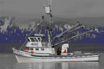
 Alaskan Gyre |
| Survey Equipment | Survey Info | Data Type(s) | Data Collected |
|---|---|---|---|
| Multichannel | --- | Multichannel | |
| subbottomprofiler | --- | Sub Bottom Profiler |