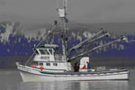
AKA: none
Other ID: A-01-11-GA
Status: Completed
Organization(s): USGS, Pacific Coastal and Marine Science Center
Funding Program(s): Marine and Coastal Catastrophic Hazards Project (ZP00C4A)
Principal Investigator(s): Thomas Parsons
Affiliate Investigator(s):
Information Specialist(s): David Finlayson, Patrick Hart
Data Type(s): Location-Elevation: Navigation, Seismics: Sparker, Sonar: Multibeam, Sonar: Sidescan
Scientific Purpose/Goals: To map past tsunamigenic landslides with multibeam bathymetry and subbottom profiling.
Vehicle(s):
Start Port/Location: Whittier, AK
End Port/Location: Whittier, AK
Start Date: 2011-08-15
End Date: 2011-08-22
Equipment Used: minisparker, navigation, multibeam, sidescansonar
Information to be Derived: To map past tsunamigenic landslides with multibeam bathymetry and subbootom profiling.
Summary of Activity and Data Gathered:
Staff: David Finlayson, Patrick Hart, Thomas Parsons
Affiliate Staff:
Peter Haeussler
Notes: Staff information imported from InfoBank
David Finlayson
Pat Hart
Peter Haeussler
Tom Parsons
Location:
Gulf of Alaska: Whittier
| Boundaries | |||
|---|---|---|---|
| North: 60.82734 | South: 60.7767 | West: -148.716 | East: -148.47614 |
Platform(s):
 Alaskan Gyre |
FAN A0111GA has data viewable in the GeoMappApp/Virtual Ocean applications. To view this data in these applications go to http://www.geomapapp.org/ and http://www.virtualocean.org/. See the instructions for locating USGS data in these applications. You can also view the imagery created from the SEGY data at https://cmgds.marine.usgs.gov/images.php?cruise=A0111GA.
| Survey Equipment | Survey Info | Data Type(s) | Data Collected |
|---|---|---|---|
| minisparker | --- | Sparker | |
| navigation | --- | Navigation | Global positioning system (GPS) data a-01-11-ga.063 ( Provisional best file ) Best file with nav in ArcInfo E00 format a-01-11-ga.zip |
| multibeam | --- | Multibeam | |
| sidescansonar | --- | Sidescan |