AKA: none
Other ID: A-1-00-SC
Status: Completed
Organization(s): USGS, Pacific Coastal and Marine Science Center
Funding Program(s): Southern California Seismic Hazards Project (MU271)
Principal Investigator(s): Brian Edwards, Chris Gutmacher, Stephanie Ross
Affiliate Investigator(s):
Information Specialist(s): Chris Gutmacher
Data Type(s): Location-Elevation: Navigation, Seismics: Boomer, Seismics: Multichannel, Seismics: Sparker, Sonar: Single Beam
Scientific Purpose/Goals: leg 1: identify fault and landslide hazards in the offshore area of Southern California. The study areas were selected to (a) obtain multichannel and high-resolution seismic-reflection data inside the 3-mile limit between Port Hueneme and the Mexican border; and (b) extend data coverage within a relatively unsurveyed segment of the margin seaward of the shelf between Dana Point and San Diego, California. leg 2: to obtain multichannel and high-resolution data in Los Angeles/Long Beach harbor and adjacent shelf for study of salt-water intrusion in local aquifers.
Vehicle(s):
Start Port/Location: Redwood City, CA
End Port/Location: Redwood City, CA
Start Date: 2000-06-05
End Date: 2000-06-29
Equipment Used: 12khz, Huntec, Geopulse, minisparker, GPS, YoNav, 24channel, sparker, uniboom
Information to be Derived: Identify and map active and potentially active faults, folds, and submarine slide-prone areas that may threaten densely populated areas of Southern California. Map pathways of salt-water intrusion into local aquifers critical to the large population of the greater Los Angeles metropolitan area.
Summary of Activity and Data Gathered: Extensive high-resolution geopulse and huntec data were collected within the 3-mile limit and farther seaward in areas sparsely surveyed during previous operations, as well as in the Los Angeles / Long Beach harbor and adjacent shelf. Problems with the minisparker power supplies prevented its use during much of the cruise, despite unflagging efforts by the shipboard engineering and electronic technicians. In the end, only 36 hours of multichannel minisparker data were collected in the harbor/shelf area and an additional 10 hours in the shelf and slope area east of Port Hueneme. 1200 line-km geopulse (960 hazards, 240 aquifers) 1400 line-km huntec (1300 hazards, 100 aquifers) 470 line-km minisparker (100 hazards, 370 aquifers)
Staff: Jonathan Childs, Becky Cooper, Timothy Elfers, Dave Gonzales, Patrick Hart, Dave Hogg, Larry Kooker, Walt Olson, Kevin O'Toole, Jane Reid, Ray Sliter
Affiliate Staff:
Martin Uyesugi (Geoforce Consultants) - Huntec Engineer Watchstander
Annie Douglas (Cascadia Research) - Mammal Observer
Lisa Baraff (Cascadia Research) - Mammal Observer
Dave Ellifrit (Cascadia Research) - Mammal Observer
Todd Chandler (Cascadia Research) - Mammal Observer Team Leader
Jr Veldink (Cascadia Research) - Mammal Observer
Dick Corrigan (Northwind Shipyards) - Captain
Ted Blinkers (Northwind Shipyards) - Captain
Jeff Stringer (Northwind Shipyards) - Mate
James Stacey (Northwind Shipyards) - Engineer
Ricky Labrador (Northwind Shipyards) - Cook
Rich Soderblom (Northwind Shipyards) - Deck Hand
Brad Scarrott (Applied Acoustic Engineering) - Minisparker Technician
Notes: physical holdings
Staff information imported from InfoBank
Chris Gutmacher (Watchstander, USGS Western Region) - Chief Scientist
Stephanie Ross (Watchstander, USGS Western Region) - Chief Scientist
Brian Edwards (USGS Western Region) - Chief Scientist
Larry Kooker (USGS Western Region) - Electronics Technician
Kevin O'Toole (USGS Western Region) - Mechanical Technician
Ray Sliter (channel Seismic Watchstander, USGS Western Region) - Multi
Becky Cooper (USGS Western Region) - Watchstander Navigation
Pat Hart (channel Seismic Watchstander, USGS Western Region) - Multi
Jon Childs (channel Seismic Watchstander, USGS Western Region) - Multi
Dave Gonzales (USGS Western Region) - Electronics Technician
Jane Reid (USGS Western Region) - Watchstander
Dave Hogg (USGS Western Region) - Electronics Technician
Tim Elfers (USGS Western Region) - Mechanical Technician
Walt Olson (USGS Western Region) - Mechanical Technician
Martin Uyesugi (Geoforce Consultants) - Huntec Engineer Watchstander
Annie Douglas (Cascadia Research) - Mammal Observer
Lisa Baraff (Cascadia Research) - Mammal Observer
Dave Ellifrit (Cascadia Research) - Mammal Observer
Todd Chandler (Cascadia Research) - Mammal Observer Team Leader
Jr Veldink (Cascadia Research) - Mammal Observer
Dick Corrigan (Northwind Shipyards) - Captain
Ted Blinkers (Northwind Shipyards) - Captain
Jeff Stringer (Northwind Shipyards) - Mate
James Stacey (Northwind Shipyards) - Engineer
Ricky Labrador (Northwind Shipyards) - Cook
Rich Soderblom (Northwind Shipyards) - Deck Hand
Brad Scarrott (Applied Acoustic Engineering) - Minisparker Technician
Location:
Southern California from Port Hueneme to Mexican Border
| Boundaries | |||
|---|---|---|---|
| North: 34.22868 | South: 32.58602 | West: -119.791 | East: -117.13802 |
Platform(s):
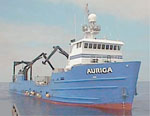 Auriga |
Ehman, K.D., and Edwards, B.D., 2017, A Foundation for Future Assessment and Management of Groundwater Resources: , AAPG Datapages, Inc., Search and Discovery. AAPG, Houston, TX URL: http://www.searchanddiscovery.com/pdfz/documents/2017/80599ehman/ndx_ehman.pdf.html.
Fisher, M., Normark, W., Langenheim, V., Calvert, A., and Sliter, R., 2005, Marine Geology and Earthquake Hazards of the San Pedro Shelf Region, Southern California: U.S. Geological Survey Professional Paper 1687, http://pubs.usgs.gov/pp/pp1687/.
Gutmacher, C.E., Normark, William R., Ross, Stephanie L., Edwards, Brian D., Sliter, Ray, Hart, Patrick, Cooper, Becky, Childs, Jon, and Reid, Jane A., 2000, Cruise report for A1-00-SC southern California earthquake hazards project, part A: U.S. Geological Survey Open-File Report 2000-516, http://pubs.usgs.gov/of/2000/0516/.
Ryan, H.F., Conrad, J.E., Paull, C.K., McGann, M., 2012, Slip Rate on the San Diego Trough Fault Zone, Inner California Borderland, and the 1986 Oceanside Earthquake Swarm Revisited: Bulletin of the Seismological Society of America, v. 102 no. 6, pp. 2300–2312, doi: 10.1785/0120110317.
Ryan, H.F., Legg, M.R., Conrad, J.E., and Sliter, R.W., 2009, Recent faulting in the Gulf of Santa Catalina; San Diego to Dana Point; Earth science in the urban ocean; the Southern California continental borderland, in Lee, H.J., and Normark, W.R., eds., Earth Science in the Urban OceanâThe Southern California Continental Borderland: Geological Society of America Special Paper 454, pp. 291–315, doi: 10.1130/2009.2454(4.2).
Schreppel, H.A., Degnan, C.H, Dadisman, S.V., and Metzger, D.R., 2013, Archive of U.S. Geological Survey Selected Single-Beam Bathymetry Datasets, 1969â2000: U.S. Geological Survey Data Series 757, http://pubs.usgs.gov/ds/757/.
Schreppel, H.A., Degnan, C.H., Dadisman, S.V., Metzger, D.R., 2013, Archive of U.S. Geological Survey selected single-beam bathymetry datasets, 1969-2000: U.S. Geological Survey Data Series 757, https://doi.org/10.3133/ds757.
Sliter, R.W., Normark, William R., and Gutmacher, Christina E., 2005, Multichannel seismic-reflection data acquired off the coast of southern California-Part A 1997, 1998, 1999, and 2000: U.S. Geological Survey Open-File Report 2005-1084, http://pubs.usgs.gov/of/2005/1084/.
Wolf, S., and Gutmacher, C., 2004, Geologic and Bathymetric Reconnaissance Overview of the San Pedro Shelf Region, Southern California: U.S. Geological Survey Open-File Report 2004-1049, http://pubs.usgs.gov/of/2004/1049/.
FAN A100SC has data viewable in the GeoMappApp/Virtual Ocean applications. To view this data in these applications go to http://www.geomapapp.org/ and http://www.virtualocean.org/. See the instructions for locating USGS data in these applications. You can also view the imagery created from the SEGY data at https://cmgds.marine.usgs.gov/images.php?cruise=A100SC.
FAN A100SC has data viewable in the GeoMappApp/Virtual Ocean applications. To view this data in these applications go to http://www.geomapapp.org/ and http://www.virtualocean.org/. See the instructions for locating USGS data in these applications. You can also view the imagery created from the SEGY data at https://cmgds.marine.usgs.gov/images.php?cruise=A100SC.
