AKA: none
Other ID: B-05-11-CC
Status: Completed
Organization(s): USGS, Pacific Coastal and Marine Science Center
Funding Program(s): Coastal and Marine Catastrophic Hazards (ZP00C4A)
Principal Investigator(s): Samuel Johnson
Affiliate Investigator(s):
Information Specialist(s): Ray Sliter, Janet Watt
Data Type(s): Electro-Magnetic: Magnetics, Location-Elevation: Navigation, Seismics: Sparker
Scientific Purpose/Goals: Data acquisition to constrain geoloogic framework and active faulting
Vehicle(s):
Start Port/Location: Moss Landing
End Port/Location: Moss Landing or Morro Bay
Start Date: 2011-09-12
End Date: 2011-09-26
Equipment Used: GPS, Mini-sparker, magnetometer
Information to be Derived: Seismic reflection and marine magnetic profiles
Summary of Activity and Data Gathered:
Staff: Samuel Johnson, Janet Watt
Affiliate Staff:
Janet Tilden Watt
Notes: Staff information imported from InfoBank
Sam Johnson
Janet Tilden Watt
Location:
Mostly offshore Big Sur (between Monterey and Morro Bay). Perhaps some time (a few days) around Point Sal to Point Arguello)
| Boundaries | |||
|---|---|---|---|
| North: 36.9589 | South: 35.29984 | West: -122.056 | East: -120.86195 |
Platform(s):
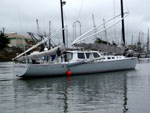 Derek M. Baylis |
Johnson, S.Y., Hartwell, S.R., Sliter, R.W., and Beeson, J.W., 2017, Minisparker seismic-reflection data of field activity B-05-11-CC, from Point Sur to Morro Bay, offshore central California, 2011-09-12 to 2011-09-26: U.S. Geological Survey data release.
Johnson, S.Y., Hartwell, S.R., Watt, J.T., Beeson, J.W., Dartnell, P., 2019, Offshore shallow structure and sediment distribution, Point Sur to Point Arguello, central California: U.S. Geological Survey Open-File Report 2018â1158, https://doi.org/10.3133/ofr20181158.
Johnson, S.Y., Hartwell, S.R., Watt, J.T., Beeson, J.W., Dartnell, P., and Cochran, S.A., 2019, California State Waters Map Series Data Catalog--Point Sur to Point Arguello Region, California: U.S. Geological Survey data release.
Watt, J.T., Hartwell, S.R., and Johnson, S.Y., 2018, Marine magnetic data from Point Sur to Piedras Blancas, central California, 2011: U.S. Geological Survey data release.
FAN B0511CC has data viewable in the GeoMappApp/Virtual Ocean applications. To view this data in these applications go to http://www.geomapapp.org/ and http://www.virtualocean.org/. See the instructions for locating USGS data in these applications. You can also view the imagery created from the SEGY data at https://cmgds.marine.usgs.gov/images.php?cruise=B0511CC.
| Survey Equipment | Survey Info | Data Type(s) | Data Collected |
|---|---|---|---|
| GPS | --- | Navigation | Global positioning system (GPS) data (Provisional best file) Best file with nav in ArcInfo E00 formatProvisional best file (Provisional best file) |
| Mini-sparker | --- | Sparker | Seismic FFID/Shot/CDP data (Provisional best file) Sparker (Metadata) Minisparker seismic-reflection data collected between Point Sur and Morro Bay, offshore of central California (This dataset includes raw, and swell-filtered, high-resolution seismic-reflection data, collected by the U.S. Geological Survey (USGS) in 2011, between Point Sur and Morro Bay in central California.) Best file with nav in ArcInfo E00 format (Arc Files) |
| magnetometer | --- | Magnetics | Marine magnetic data from Point Sur to Piedras Blancas, central California, 2011 (This dataset includes marine magnetic data collected by the U.S. Geological Survey (USGS) in 2011 during field activity B-05-11-CC between Point Sur and Piedras Blancas, central California.) |
