AKA: none
Other ID: B-1-72-BS
Status: Completed
Organization(s): USGS, Pacific Coastal and Marine Science Center
Funding Program(s):
Principal Investigator(s):
Affiliate Investigator(s):
Information Specialist(s): Alan Cooper
Data Type(s): Electro-Magnetic: Magnetics, Location-Elevation: Navigation, Sonar: Single Beam
Scientific Purpose/Goals:
Vehicle(s):
Start Port/Location:
End Port/Location:
Start Date: 1972-08-27
End Date: 1972-09-17
Equipment Used: bathymetry, magnetics, integratednavigation
Information to be Derived:
Summary of Activity and Data Gathered:
Staff:
Affiliate Staff:
Notes:
Location:
Alaska
| Boundaries | |||
|---|---|---|---|
| North: 60.145 | South: 52.0896 | West: -179.2994 | East: -168.207 |
Platform(s):
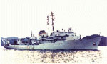 Silas Bent |
| Survey Equipment | Survey Info | Data Type(s) | Data Collected |
|---|---|---|---|
| bathymetry | --- | Single Beam | Raw depth (bathymetry) data (Provisional best file) |
| magnetics | --- | Magnetics | Edited magnetics data (Provisional best file) sparker - magnetics profile plots (Analog Materials list) |
| integratednavigation | --- | Navigation | Integrated navigation (SINS) data (Provisional best file) |
