AKA: B0510NC
Other ID: B-5-10-NC
Status: Completed
Organization(s): USGS, Pacific Coastal and Marine Science Center
Funding Program(s): Coastal and Marine Catastrophic Hazards (ZP00C4A)
Principal Investigator(s): Samuel Johnson
Affiliate Investigator(s):
Information Specialist(s): Jackson Currie
Data Type(s): Location-Elevation: Navigation, Seismics: Sparker, Seismics: Sub Bottom Profiler
Scientific Purpose/Goals: characterization of northern San Andreas fault
Vehicle(s):
Start Port/Location: Noyo Harbor, Fort Bragg
End Port/Location: Noyo Harbor, Fort Bragg
Start Date: 2010-09-20
End Date: 2010-10-01
Equipment Used: GPS, 512 chirp, minisparker, single channel streamer, 512 chirp-source
Information to be Derived: Shallow geologic structure and stratigraphy
Summary of Activity and Data Gathered:
Staff:
Affiliate Staff:
Notes:
Location:
offshore Fort Bragg
| Boundaries | |||
|---|---|---|---|
| North: 40.0219 | South: 39.42528 | West: -124.239 | East: -123.80516 |
Platform(s):
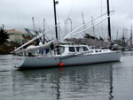 Derek M. Baylis |
Beeson, J.W., and Johnson, S.Y., 2019, Offshore shallow structure and sediment distribution, Punta Gorda to Point Arena, northern California: U.S. Geological Survey Open-File Report 2019-1072, https://doi.org/10.3133/ofr20191072.
Beeson, J.W., Johnson, S.Y., and Cochran, S.A., 2019, California State Waters Map Series Data Catalog--Punta Gorda to Point Arena Region, California: U.S. Geological Survey data release, https://doi.org/10.5066/P9PNNI9H.
Beeson, J.W., Johnson, S.Y., Goldfinger, C., and Hartwell, S.R., 2016, Marine Geophysical Data - Point Arena to Cape Mendocino: U.S. Geological Survey data release.
FAN B510NC has data viewable in the GeoMappApp/Virtual Ocean applications. To view this data in these applications go to http://www.geomapapp.org/ and http://www.virtualocean.org/. See the instructions for locating USGS data in these applications. You can also view the imagery created from the SEGY data at https://cmgds.marine.usgs.gov/images.php?cruise=B510NC.
| Survey Equipment | Survey Info | Data Type(s) | Data Collected |
|---|---|---|---|
| GPS | --- | Navigation | Global positioning system (GPS) data (Provisional best file) |
| 512 chirp | --- | Sub Bottom Profiler | Seismic FFID/Shot/CDP data (Provisional best file) chirp (Metadata) |
| minisparker | --- | Sparker | Cradle of the earthquake; Exploring the underwater San Andreas Fault 2010: National Oceanic and Atmospheric Administration (NOAA) Ocean Explorer Explorations, accessed October 6, 2010 (Publication) Seismic FFID/Shot/CDP data (Provisional best file) sparker (Metadata) GEoMappApp files |
| single channel streamer | --- | Sparker | corrected SEG-Y (published in Science Base; U.S. Geological Survey data release, DOI:10.5066/F7GT5K8R) |
| 512 chirp-source | --- | Sub Bottom Profiler |
