AKA: none
Other ID: C-02-13-PS
Status: Completed
Organization(s): Swinomish Tribe, USGS, Western Fisheries Research Center, Squaxin Island Tribe, Samish Indian Nation, Nisqually Tribe, USGS, Pacific Coastal and Marine Science Center
Funding Program(s): Multidisciplinary Studies of Large River Deltas in Puget Sound (MU191)
Principal Investigator(s): Eric Grossman
Affiliate Investigator(s):
Information Specialist(s): Eric Grossman
Data Type(s):
Scientific Purpose/Goals: Characterize the variability and processes affecting surface water and water column habitat conditions across the Salish Sea and identify patterns associated with land use and climate change.
Vehicle(s):
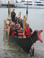
Start Port/Location: LEAVE various; Squaxin Island, Fidalgo Bay
End Port/Location: ARRIVE Quinault (Tahola), WA
Start Date: 2013-07-15
End Date: 2013-08-01
Equipment Used:
Information to be Derived: surface water properties/quality data along several routes of the Salish Sea Tribal Journey
Summary of Activity and Data Gathered:
Staff:
Affiliate Staff:
Sarah Grossman
Swinomish Indian Tribal Community
Squaxin Island Tribe
Nisqually Tribe
Samish Indian Nation
Notes:
Staff information imported from InfoBank
Sarah Grossman
Swinomish Indian Tribal Community
Squaxin Island Tribe
Nisqually Tribe
Samish Indian Nation
Location:
Georgia Strait)
| Boundaries | |||
|---|---|---|---|
| North: 49.75 | South: 47.25 | West: -125.75 | East: -122.25 |
Platform(s):
 Canoe |
