AKA: none
Other ID: C-1-10-NC
Status: Completed
Organization(s): USGS, Pacific Coastal and Marine Science Center
Funding Program(s): Coastal and Marine Catastrophic Hazards (ZP00C4A)
Principal Investigator(s): Samuel Johnson
Affiliate Investigator(s):
Information Specialist(s): Ray Sliter
Data Type(s): Electro-Magnetic: Magnetics, Location-Elevation: Navigation, Seismics: Boomer, Seismics: Sparker
Scientific Purpose/Goals: characterization of northern San Andreas fault
Vehicle(s):
Start Port/Location: Noyo Harbor, Fort Bragg
End Port/Location: Noyo Harbor, Fort Bragg
Start Date: 2010-08-09
End Date: 2010-08-15
Equipment Used: magnetics, chirp, sparker, navigation
Information to be Derived: Shallow geologic structure and stratigraphy
Summary of Activity and Data Gathered:
Staff:
Affiliate Staff:
Notes:
Location:
offshore Fort Bragg
| Boundaries | |||
|---|---|---|---|
| North: 39.56208 | South: 39.02353 | West: -123.965 | East: -123.702 |
Platform(s):
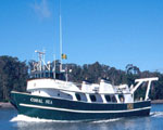 Coral Sea |
Beeson, J.W., and Johnson, S.Y., 2019, Offshore shallow structure and sediment distribution, Punta Gorda to Point Arena, northern California: U.S. Geological Survey Open-File Report 2019-1072, https://doi.org/10.3133/ofr20191072.
Beeson, J.W., Johnson, S.Y., and Cochran, S.A., 2019, California State Waters Map Series Data Catalog--Punta Gorda to Point Arena Region, California: U.S. Geological Survey data release, https://doi.org/10.5066/P9PNNI9H.
Beeson, J.W., Johnson, S.Y., Goldfinger, C., and Hartwell, S.R., 2016, Marine Geophysical Data - Point Arena to Cape Mendocino: U.S. Geological Survey data release.
FAN C110NC has data viewable in the GeoMappApp/Virtual Ocean applications. To view this data in these applications go to http://www.geomapapp.org/ and http://www.virtualocean.org/. See the instructions for locating USGS data in these applications. You can also view the imagery created from the SEGY data at https://cmgds.marine.usgs.gov/images.php?cruise=C110NC.
| Survey Equipment | Survey Info | Data Type(s) | Data Collected |
|---|---|---|---|
| magnetics | --- | Magnetics | magnetics (published on Science Base; U.S. Geological Survey data release, DOI: 10.5066/F7GT5K8R) |
| chirp | --- | Boomer | Seismic FFID/Shot/CDP data c-1-10-nc.410_chirp (Provisional best file) chirp survey information |
| sparker | --- | Sparker | Seismic FFID/Shot/CDP data c-1-10-nc.410_061_sparker (Provisional best file) GeoMappApp files sparker survey information raw SEG-Y (published on Science Base; U.S. Geological Survey data release, DOI: 10.5066/F7GT5K8R) corrected SEG-Y data (published on Science Base; U.S. Geological Survey data release, DOI: 10.5066/F7GT5K8R) |
| navigation | --- | Navigation | Field activity C-1-10-NC: Navigation data for marine geophysical data collected collected between Fort Bragg and Point Arena (northern California) from 08/09/2010 to 08/15/2010 (This dataset includes navigation data for marine geophysical data jointly collected by the U.S. Geological Survey (USGS) and Oregon State University in 2010, between Fort Bragg and Point Arena in northern California.) |
