AKA: none
Other ID: F-6-87-NC
Status: Completed
Organization(s):
Funding Program(s):
Principal Investigator(s): Steve Lewis, Dave McCulloch
Affiliate Investigator(s):
Information Specialist(s):
Data Type(s): Location-Elevation: Navigation, Sampling: Geology, Seismics: Multichannel, Seismics: Sub Bottom Profiler
Scientific Purpose/Goals:
Vehicle(s):
Start Port/Location: Redwood City, CA
End Port/Location: ?
Start Date: 1987-11-10
End Date: 1987-11-24
Equipment Used: chaindredge, 2channelairgun, 2channelwatergun, integratednavigation, 3.5khz, dartcore
Information to be Derived:
Summary of Activity and Data Gathered: physical data holdings
Staff:
Affiliate Staff:
Notes: Sampling Northern California framework
Staff information imported from InfoBank
Dave McCulloch (USGS Western Region) - Chief Scientist
Steve Lewis (USGS Western Region) - Chief Scientist
Location:
Northern California
| Boundaries | |||
|---|---|---|---|
| North: 39.06183 | South: 34.21667 | West: -124.2 | East: -121.11667 |
Platform(s):
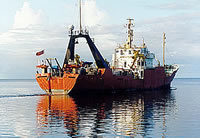
 Farnella |
Adamczyk, K., Mizell, K., Payan, D., Dominguez, N.O., Oliva, L., and Gartman, A., 2023, Marine mineral geochemical data - Part One: Pacific Ocean USGS-affiliated historical data: U.S. Geological Survey data release, https://doi.org/10.5066/P9GD1JKB.
Gibbs, A.E., and Hein, J.R., 1993, Palygorskite and Fe-Mn mineralization at a Central California margin fracture zone: , Geological Society of America Abstracts with Programs. , pp. 442–442.
Gibbs, A.E., Hein, J.R., Lewis, S.D., and McCulloch, D.S., 1993, Hydrothermal palygorskite and ferromanganese mineralization at a Central California margin fracture zone: Marine Geology, v. 115 no. 1-2, pp. 47–65.
| Survey Equipment | Survey Info | Data Type(s) | Data Collected |
|---|---|---|---|
| chaindredge | --- | Geology | f-6-87-nc.palygorskite.smearslides.pdf f-6-87-nc.palygorskite.paleontologicalanalysis.pdf f-6-87-nc.palygorskite.toc.pdf Station Information f-6-87-nc.palygorskite.sampledescription.d8.pdf f-6-87-nc.palygorskite.sem.pdf |
| 2channelairgun | --- | Multichannel | Survey information |
| 2channelwatergun | --- | Multichannel | Survey information |
| integratednavigation | --- | Navigation | Best file with nav in ArcInfo E00 format Eotvos/course/speed/distance data f-6-87-nc.072 (Provisional best file) Eotvos/course/speed/distance data f-6-87-nc.072_degree Integrated navigation (SINS) data f-6-87-nc.052 |
| 3.5khz | --- | Sub Bottom Profiler | Survey information |
| dartcore | --- | Geology |