AKA: none
Other ID: I-10-90-AT,AMASSEDS_CRUISE_III
Status: Completed
Organization(s): USGS, Pacific Coastal and Marine Science Center, Woods Hole Oceanographic Institution, University of Washington
Funding Program(s):
Principal Investigator(s):
Affiliate Investigator(s): Richard Sternberg (UW)
Information Specialist(s):
Data Type(s): Time Series: Mooring (physical oceanography), Sampling: Biology
Scientific Purpose/Goals: To study the movement of sediment particles in the water column, the accumulation of sediment particles on the seabed, and the effects that sediment particles have on geochemical processes in the water column and seabed.
Vehicle(s):
Start Port/Location:
End Port/Location:
Start Date: 1990-06-16
End Date: 1990-06-24
Equipment Used: Geoprobe, nets
Information to be Derived:
Summary of Activity and Data Gathered: The instrumented moorings and instrumented tripod, GEOPROBE, were recovered during this leg. These instruments had all been deployed during AmasSeds Cruise 2 in February 1990. The mooring at site M-1 was recovered first with all instruments except for one Datawell Waverider which apparently broke free and drifted out of the study. All instruments were recovered from site M-3 with no complications. At site M-2 the instrumented mooring had to be dragged for with grappling hooks because all surface buoys deployed at M-2 had broken free. All instruments on the mooring wee recovered by dragging except for one which was subsequently found and returned by Brazilian fishermen. The instrumented-tripod, GEOPROBE, was recovered using a trawling net. The instruments on the tripod were recovered undamaged and with data preserved.
Staff: Gail Kineke, George Tate, William J. Strahle, Luiz DeMiranda, Reinaldo Boneto, Valdenira Ferreira, A. Fernandes, Joanne Thede
Affiliate Staff:
Robert Beardsley (WHOA) - Unspec. Inv.
Richard Limeburner (WHOA) - Unspec. Inv.
Peter Clay (WHOA) - Unspec. Inv.
Scott Worrilow (WHOA) - Unspec. Inv.
David Simoneau (WHOA) - Unspec. Inv.
Nelson Hogg (Navy) - Unspec. Inv.
Belmiro Castro - Unspec. Inv.
Paul Oliveira Alcarpe - Unspec. Inv.
Marnio Nepolo Alves - Unspec. Inv.
E. Walcott - Unspec. Inv.
Notes:
Staff information imported from InfoBank
Richard Sternberg (UW) - Chief Scientist
Robert Beardsley (WHOA) - Unspec. Inv.
Richard Limeburner (WHOA) - Unspec. Inv.
Peter Clay (WHOA) - Unspec. Inv.
Scott Worrilow (WHOA) - Unspec. Inv.
David Simoneau (WHOA) - Unspec. Inv.
Gail Kineke (UW) - Unspec. Inv.
George Tate (USGS Western Region) - Unspec. Inv.
Joanne Ferreira (USGS Western Region) - Unspec. Inv.
Bill Strahle (USGS Western Region) - Unspec. Inv.
Nelson Hogg (Navy) - Unspec. Inv.
Belmiro Castro - Unspec. Inv.
Luiz DeMiranda - Unspec. Inv.
Reinaldo Boneto - Unspec. Inv.
Paul Oliveira Alcarpe - Unspec. Inv.
Marnio Nepolo Alves - Unspec. Inv.
Valdenira Ferreira Dos Santos - Unspec. Inv.
E. Walcott - Unspec. Inv.
A. Fernandes - Unspec. Inv.
Location:
Atlantic Ocean
| Boundaries | |||
|---|---|---|---|
| North: 19.75 | South: -9.75 | West: -59.75 | East: -29.75 |
Platform(s):
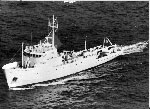 Columbus Iselin |
Rine, J.M. and N., Charles A., 1990, Report on field measurements and sampling during AmasSeds Cruise II - CI9004. Marine Sciences Research Center, State University of New York, NY. November 1990, 94 p.
| Survey Equipment | Survey Info | Data Type(s) | Data Collected |
|---|---|---|---|
| Geoprobe | --- | Mooring (physical oceanography) | |
| nets | --- | Biology |
