AKA: none
Other ID: M-1-74-NP,CCTWO1MV
Status: Completed
Organization(s):
Funding Program(s): Hydrothermal System of the East Pacific Rise (MU144)
Principal Investigator(s): Bill Normark
Affiliate Investigator(s): J. Mudie
Information Specialist(s):
Data Type(s): Electro-Magnetic: Magnetics, Imagery: Photo, Location-Elevation: Navigation, Seismics: Sub Bottom Profiler, Sonar: Sidescan, Sonar: Single Beam
Scientific Purpose/Goals:
Vehicle(s):
Start Port/Location:
End Port/Location:
Start Date: 1974-08-26
End Date: 1974-09-20
Equipment Used: transitsatellite, 3.5khz, 12khz, magnetics, sidescansonar, 4khz, 20khz, underwatercamera, gyro
Information to be Derived:
Summary of Activity and Data Gathered:
Staff:
Affiliate Staff:
Notes:
Staff information imported from InfoBank
J. Mudie - Chief Scientist
Bill Normark (USGS Western Region) - Chief Scientist
Location:
Northern Pacific
| Boundaries | |||
|---|---|---|---|
| North: 32.6789 | South: 8.0452 | West: -117.498 | East: -100.0349 |
Platform(s):
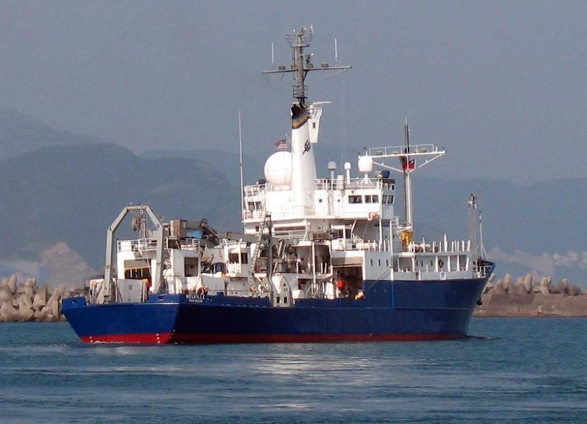 Melville |
Ballard, R.D., Francheteau, J., Juteau, T., Rangan, C., and Normark, W.R.,, 1981, East Pacific Rise at 21 degrees N; the volcanic, tectonic, and hydrothermal processes of the central axis: Earth and Planetary Science Letters, v. 55 no. 1, pp. 1–10.
Crane, K., and Normark, W.R., 1977, Hydrothermal activity and crestal structure of the East Pacific Rise at 21 degrees N: Journal of Geophysical Research, v. 82 no. 33, pp. 5336–5348.
Crane, K., and Normark, W.R., 1975, Ridge crest structure vs. hydrothermal activity (East Pacific Rise 21 degrees N): Eos, Transactions, American Geophysical Union, v. 56 no. 12, pp. 1064–1065.
Hess, G.R., Lawhead, B., Lichtman, G.S., MacDonald, K.C., Miller, S.M., Normark, W.R., and Spiess, F.N., 1980, Fine-scale bathymetry used for submersible studies of the East Pacific Rise: U.S. Geological Survey Open-File Report 80-542, 2 p.
Lichtman, G.S., Normark, W.R., Spiess, F.N., and Hess, G.R., 1979, Detailed morphology and photogeology of the East Pacific Rise near lat. 21 degrees N: , Geological Society of America Abstracts with Programs. , pp. 466–466.
Normark, W.R., 1976, Delineation of the main extrusion zone of the East Pacific Rise at lat 21 degrees N: Geology, v. 4 no. 11, pp. 681–685.
Normark, W.R., 1975, Photographic study of the zone of crustal accretion of the East Pacific Rise crest at the mouth of the Gulf of California: , Geological Society of America Abstracts with Programs. , pp. 358–358.
Normark, W.R., Alpha, T.R., Hess, G.R., Lichtman, G.S., and Gutmacher, C.E., 1978, Map showing the crest of the East Pacific Rise near the mouth of the Gulf of California: U.S. Geological Survey Open-File Report 78-350, 1 p.
Normark, W.R., and Bischoff, J.L., 1980, Hydrothermal activity and massive sulfides on the East Pacific Rise: U. S. Geological Survey Professional Paper 1175, pp. 163–163.
Normark, W.R., and Hess, G.R., 1979, Deep-tow studies of the East Pacific Rise off Mexico: U. S. Geological Survey Professional Paper 1150, pp. 157–157.
Normark, W.R., and Hess, G.R.,, 1978, Deep-tow studies of the East Pacific Rise, Pacific Ocean basin: U. S. Geological Survey Professional Paper 1100, pp. 158–158.
Normark, W.R., 1980, Definition of the plate boundary along the East Pacific Rise off Mexico: Marine Geodesy, v. 4 no. 1, pp. 29–41.
Normark, W.R., 1990, Return to Ranger submarine slide, Baja California, Mexico: Geo-Marine Letters, v. 10 no. 2, pp. 81–91.
Wilde, P., Chase, T.E., Holmes, M.L., Normark, W.R., and Thomas, J.A., 1977, Oceanographic data off Washington, 46 degrees to 49 degrees north including the Nitinat deep sea fan: Lawrence Berkeley Laboratory, Energy and Environment Division, no. 223, 1 p.
| Survey Equipment | Survey Info | Data Type(s) | Data Collected |
|---|---|---|---|
| transitsatellite | --- | Navigation | Best file with nav in ArcInfo E00 format Integrated navigation (SINS) data m-1-74-np.050 (Provisional best file) Integrated navigation (SINS) data m-1-74-np.050_degree |
| 3.5khz | --- | Sub Bottom Profiler | |
| 12khz | --- | Single Beam | Edited bathymetry data with corrected depths m-1-74-np.320_050 (Provisional best file) Edited bathymetry data with corrected depths m-1-74-np.320 |
| magnetics | --- | Magnetics | Edited magnetics data m-1-74-np.220 Edited magnetics data m-1-74-np.220_050 (Provisional best file) |
| sidescansonar | --- | Sidescan | |
| 4khz | --- | Sub Bottom Profiler | |
| 20khz | --- | Single Beam | |
| underwatercamera | --- | Video Photo | Photos |
| gyro | --- | Navigation |
