AKA: none
Other ID: T-1-67-BS,TT018
Status: Completed
Organization(s): USGS, Pacific Coastal and Marine Science Center, University of Washington
Funding Program(s):
Principal Investigator(s): David Scholl
Affiliate Investigator(s):
Information Specialist(s):
Data Type(s): Electro-Magnetic: Magnetics, Location-Elevation: Navigation, Sampling: Geology, Seismics: Sub Bottom Profiler
Scientific Purpose/Goals: To study the size of the basins, character of the rocks, and structure of the Bering shelf.
Vehicle(s):
Start Port/Location:
End Port/Location:
Start Date: 1967-07-16
End Date: 1967-07-21
Equipment Used: magnetics, seismic, Shipekgrab, VanVeengrab, LoranA, radar, chaindredge
Information to be Derived: Continuous seismic-reflection profiles, sediment thickness, lithology, age, gold analyses, texture, mineralogy, foraminifera.
Summary of Activity and Data Gathered: Magnetic data and continuous seismic-reflection profiles were obtained along nearly 1,800 km of track, concentrated mostly in the northern Bering Sea; in addition, about 100 bottom samples and dredge hauls were taken. Interpretation of deep-penetration seismic profiles revealed a series of deep basins containing as much as 2,000 m of sediments. Dredge haul obtained shows that the acoustic basement on the continental margin consists of turbidites of late Cretaceous (Campanian) age. Rocks smapled by dredge hauls in the Pribilof Canyon and boreholes offshore at Nome show that the thick sedimentary cover in the basins is mostly of Neogene age. Upper Miocene marine rocks are present at the continental margin, and upper Miocene or Pliocene marine sediments are present off Nome. The size of the basins, character of the rocks, and abundance of minor broad folds indicate that the Bering shelf has a large and entirely unexpected petroleum potential.
Staff:
Affiliate Staff:
Notes:
Staff information imported from InfoBank
Dave Scholl (USGS Western Region) - Chief Scientist
Location:
Alaska
| Boundaries | |||
|---|---|---|---|
| North: 64.4467 | South: 54.07 | West: -170.2583 | East: -165.5567 |
Platform(s):
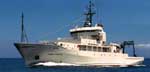 Thomas G Thompson |
Nelson, C.H., Hopkins, D.M., 1972, Sedimentary processes and distribution of particulate gold in the northern Bering Sea: U. S. Geological Survey Professional Paper 689, http://walrus.wr.usgs.gov/infobank/o/o168ns/meta/o-1-68-ns.pp_689Cite.pdf.
Nelson, C.H., Pierce, D.E., Leong, K.W., and Wang, F.F.H., 1972, Mercury distribution in Ancient and Modern Sediment of Northeastern Bering Sea: U.S. Geological Survey Open-File Report 72-0268, http://www.dggs.dnr.state.ak.us/webpubs/usgs/of/text/of72-0268.PDF.
Scholl, D.W., Buffington, E.C., and Hopkins, D.M., 1968, Geologic history of the continental margin of North America in the Bering Sea: Marine Geology, v. 6, pp. 297–330.
Scholl, D.W., Hopkins, D.M., Greene, H.G., and Buffington, E.C., 1968, New petroleum prospects, shallow and deep Bering Sea (abstract): , 43rd Annual Meeting of the American Association of Petroleum Geologists, Bakersfield, California. pp. 10–10.
Scholl, D.W., Hopkins, David M., Buffington, E.C., and Greene, H.G., 1968, New petroleum prospects, shallow and deep Bering sea: Alaska Division of Mines Minerals Report, 1967, 56 p.
Steele, W.C., Degnan, C.H., Deeter, G.B., and Riordan, J.A., 1989, Description of marine geophysical data collected by the U.S. Geological Survey and how to obtain it: U.S. Geological Survey Open-File Report 89-167, 26 p., https://pubs.er.usgs.gov/publication/ofr89167.
| Survey Equipment | Survey Info | Data Type(s) | Data Collected |
|---|---|---|---|
| magnetics | --- | Magnetics | Raw magnetics data t-1-67-bs.201 Raw magnetics data t-1-67-bs.201_050 Edited magnetics data t-1-67-bs.221_050 (Provisional best file) Raw magnetics data t-1-67-bs.200 NGDC MGD77 data - Magnetics |
| seismic | --- | Sub Bottom Profiler | |
| Shipekgrab | --- | Geology | |
| VanVeengrab | --- | Geology | |
| LoranA | --- | Navigation | Integrated navigation (SINS) data t-1-67-bs.050 (Provisional best file) Best file with nav in ArcInfo E00 format Integrated navigation (SINS) data t-1-67-bs.050_degree |
| radar | --- | Navigation | |
| chaindredge | --- | Geology |
