AKA: none
Other ID: W-1-91-NC
Status: Completed
Organization(s):
Funding Program(s):
Principal Investigator(s): George Tate
Affiliate Investigator(s):
Information Specialist(s):
Data Type(s): Time Series: Mooring (physical oceanography)
Scientific Purpose/Goals: To measure sediment transport during storms.
Vehicle(s):
Start Port/Location:
End Port/Location:
Start Date: 1991-01-07
End Date: 1991-01-07
Equipment Used: Geoprobe
Information to be Derived:
Summary of Activity and Data Gathered: Reset and redeploy two geoprobe tripods
Staff:
Affiliate Staff:
Notes:
Staff information imported from InfoBank
George Tate (USGS Western Region) - Chief Scientist
Location:
Northern California Coast
| Boundaries | |||
|---|---|---|---|
| North: 41.75 | South: 37.75 | West: -125.75 | East: -122.25 |
Platform(s):
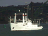 Wecoma |
| Survey Equipment | Survey Info | Data Type(s) | Data Collected |
|---|---|---|---|
| Geoprobe | --- | Mooring (physical oceanography) |
