Imagery Data System
Disclaimer: this website is preliminary and under development

Filename: 2023020FA_f02YSM_20230830T171522Z_DSC00807.JPG
Image data:
- Keywords:
- Collection:
- FAN:
2023-020-FA:
More images from FAN |
CMGDS details
- Topic: Geology, Mapping, Remote Sensing, and Geospatial Data
- Purpose: Field activity
- Type: Uncrewed Aircraft System, Structure-from-Motion
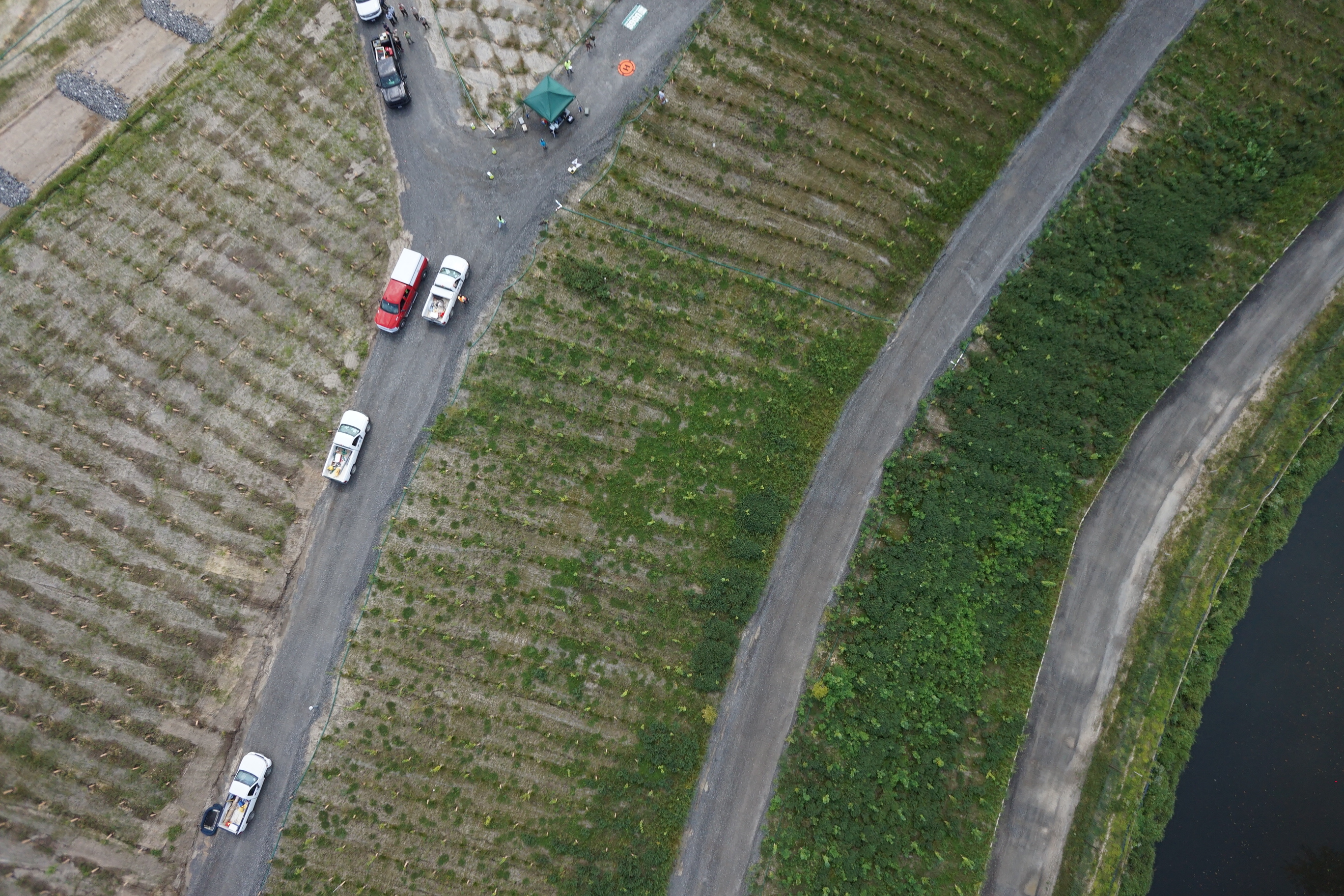
- Subject: marsh and landfill
- Semantic Location: Darby Township, PA
- People:
No people visible in image
- FAN: Woods Hole Coastal and Marine Science Center
- Public: True
- File Size: 3460136 bytes
- Uploaded By: sackerman
- Uploaded At: Nov. 20, 2024, 3:12 p.m. (UTC)
Exif tags:
- Credit: U.S. Geological Survey
- Contact: WHSC_data_contact@usgs.gov
- Copyright: Public Domain
- Image Description: https://cmgds.marine.usgs.gov/fan_info.php?fan=2023-020-FA; Low-altitude aerial photograph of the Lower Darby Creek Superfund, Darby Township, Pennsylvania, taken with the true-color camera module of the YellowScan Mapper+ LiDAR unit during USGS field activity 2023-020-FA
- Attribution URL: https://doi.org/10.5066/P1HRSCZH
- GPS Latitude: 39.90315
- GPS Latitude Reference: N
- GPS Longitude: -75.2557
- GPS Longitude Reference: W
- GPS Time Stamp (UTC): 17:15:22
- GPS Date Stamp: 2023-08-30
- GPS Area Information: position post-processed from nearby GPS
- Date/Time Original: 2023-08-30 17:15:22
- Date/Time Modified: 2023-08-30 17:15:22
- Artist: WHCMSC AIM Group
- Preserved Filename: 2023020FA_f02YSM_20230830T171522Z_DSC00807.JPG
- External Metadata Link: https://www1.usgs.gov/pir/api/identifiers/USGS:661fe103d34e7eb9eb7eca46
- Camera Make: SONY
- Camera Model: UMC-R10C