USGS Coastal and Marine Hazards and Resources Program
![]() Title | Introduction
| Methods | Reconnaissance Bathy |
Interpolated Bathy | Catalog
| Acknowlegments | References
| Figures
| Contacts
Title | Introduction
| Methods | Reconnaissance Bathy |
Interpolated Bathy | Catalog
| Acknowlegments | References
| Figures
| Contacts
 |
||
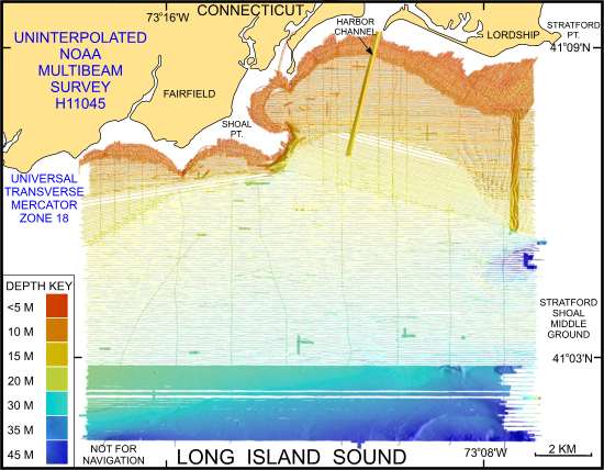
Figure 6. Image shows the original uninterpolated reconnaissance multibeam bathymetry from NOAA survey H11045 in north-central Long Island Sound off Bridgeport, Connecticut. | ||
