USGS Coastal and Marine Hazards and Resources Program
Title Page /
Table of Contents /
Introduction /
Geographic Information System /
References /
Acknowledgements
 |
||
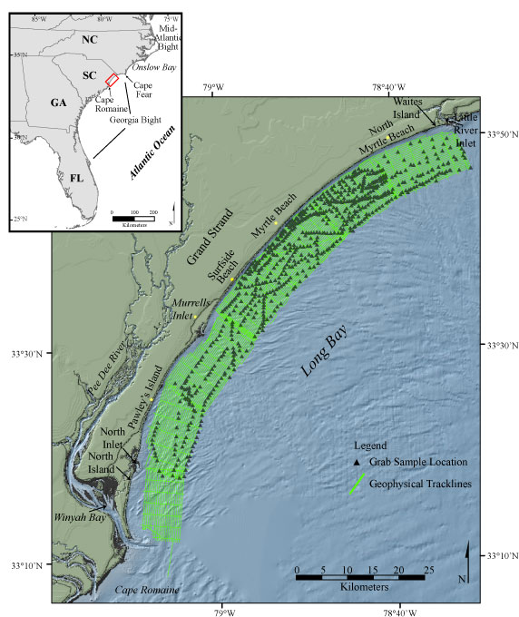
Figure 1. Map showing the location of the survey area offshore of South Carolina between Little River Inlet to the north and Winyah Bay to the south. Geophysical tracklines and sample locations are displayed. | ||
