USGS Coastal and Marine Hazards and Resources Program
Title Page /
Table of Contents /
List of Figures /
Introduction /
Maps / Data Collection/Processing / Interpretation / Acknowledgments / Appendix 1 / Appendix 2 /
Appendix 3 /
 |
||
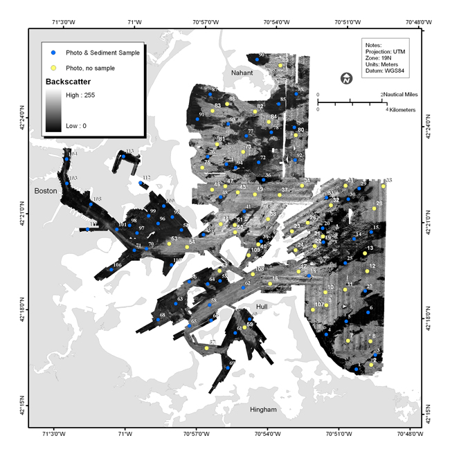
Figure 3.7. Map showing location of bottom samples on a map of acoustic backscatter intensity from sidescan sonar. Each numbered circle indicates a station where photographs, video, and/or samples were collected. See map sheet 5 for figure at a scale of 1:60,000. |