USGS Coastal and Marine Hazards and Resources Program
Title Page /
Table of Contents /
List of Figures /
Introduction /
Maps / Data Collection/Processing / Interpretation / Acknowledgments / Appendix 1 / Appendix 2 /
Appendix 3 /
 |
||
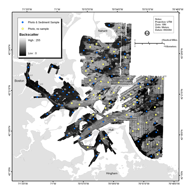
Figure A3.1. Map showing bottom sample locations and bottom photo locations overlain on the sidescan-sonar imagery. Photographs and video were obtained at all sites. Samples could not be collected at sites where the bottom was cobble or rocky (yellow dots). See Appendix 3 for a photo gallery of the images from the ground-truth survey. | ||