Woods Hole Science Center
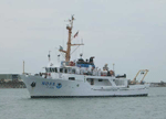
Sidescan-sonar and bathymetric data were collected aboard the NOAA Ship RUDE during July 2004 (fig. 5). NOAA hydrographic surveys provide 200-percent sidescan-sonar coverage of the sea floor by collecting two overlapping sets of sidescan-sonar data (each with a 200-m swath width and about 180-m trackline spacing) that are offset by about 90 m to ensure coverage of the nadirs. Sonar lines from one set of sidescan-sonar data were used in this study. Sidescan-sonar data were acquired with a Klein 5500 towfish (455 kHz) and recorded using Triton ISIS software in extended Triton format (xtf). Sidescan-sonar data were processed using USGS software packages Xsonar and ShowImage (Danforth, 1997). A median filtering routine was applied to the data to remove speckle noise. Sonar data were corrected for slant-range and radiometric distortion inherent in the data and towfish layback. The data were mosaicked using Xsonar, resulting in an enhanced, geographically referenced, sidescan-sonar mosaic with 1 meter/pixel resolution. Bathymetric data consisted mostly of vertical-beam echo-sounder data, with single-frequency multibeam data collected only in several areas of interest. The vertical-beam echo-sounder data were acquired during sidescan-sonar acquisition with an Odom Echotrac dual-frequency echo-sounder (24 and 200 kHz) and logged by Coastal Oceanographics Hypack Max software. Shallow-water multibeam data (455 kHz) were collected with a Reson SeaBat 8125 and logged by Triton ISIS software. Bathymetric data were integrated and processed using CARIS HIPS/SIPS software. Depths were corrected for tides and represent mean lower low water level. The integrated vertical-beam and multibeam data were imported into IVS Fledermaus to create a bathymetric surface with 45-m horizontal resolution. Detailed information on the instruments and software used on the NOAA Ship RUDE can be found in the NOAA Data Acquisition and Processing Report (National Oceanic and Atmospheric Administration, 2004). Seismic-reflection data were collected by the USGS aboard the Research Vessel NEECHO in 1980 (Needell and others, 1983b, 1983c). These data were attained with an EG&G Uniboom system, which filtered to a 400- to 4,000-Hz bandpass and recorded at a quarter-second sweep rate (Needell and others, 1983b). The seismic data have 1- to 2-m vertical resolution. |