| Identifier | D280EG | ||||||||
|---|---|---|---|---|---|---|---|---|---|
| Alternate names | D-2-80-EG,DC2-80-EG | ||||||||
| Description | Chief Scientist: Bruce Molnia. Geological and Geophysical data (airgun, minisparker, 12khz, 3dot5khz, sidescansonar, gravitycore, VanVeengrab, penetrometer, transitsatellite, pistoncore) of field activity D-2-80-EG in Eastern Gulf of Alaska from 06/10/1980 to 06/21/1980 | ||||||||
| Location | Eastern Gulf of Alaska | ||||||||
| Summary | physical data holdings | ||||||||
| Comments | Physical holdings Staff information imported from InfoBank Bruce Molnia (USGS Western Region) - Chief Scientist Charles Nixon - Captain Oskar Vennersborg - Chief Engineer Joe Bush - Mate Glen Barker - Watchstander Barbara Bellemore - Watchstander Mike Bingham - Watchstander Elly Brouwers - Watchstander Bob Hall - Watchstander Auriel Kollman - Watchstander Falma Moye - Watchstander Jim Nicholson (USGS Western Region) - Watchstander Bill Schwab - Watchstander Denree Smith (USGS Western Region) - Watchstander Rick Vail (USGS Western Region) - Watchstander Homa Lee (USGS Western Region) - Watchstander Jackie Ebby - Watchstander Ed Clukey - Watchstander Mark Perlin - Watchstander Kevin O'Toole (USGS Western Region) - Watchstander Shawn Dadisman (USGS Western Region) - Dafe Curator | ||||||||
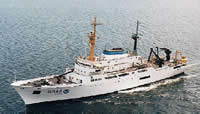
| Platform |
|
||||||||
| Itinerary |
|
||||||||
| Bounds |
|
||||||||
| Activity | Geological and Geophysical |
| Principal investigators | Molnia, Bruce | ||||||||||||||||||||||||||||||
|---|---|---|---|---|---|---|---|---|---|---|---|---|---|---|---|---|---|---|---|---|---|---|---|---|---|---|---|---|---|---|---|
| Crew members |
|
||||||||||||||||||||||||||||||
| Affiliate staff | Charles Nixon - Captain,Oskar Vennersborg - Chief Engineer,Bill Schwab - Watchstander,Mark Perlin - Watchstander |
| Data category: | Location-Elevation, Sampling, Seismics, Sonar |
|---|---|
| Data type: | Navigation, Geology, Air Gun / Water Gun, Sparker, Sub Bottom Profiler, Sidescan, Single Beam |
| Equipment | Usage description | Data types | Datasets |
|---|---|---|---|
| airgun | Air Gun / Water Gun | 1 | |
| minisparker | Sparker | 1 | |
| 12khz | Single Beam | 1 | |
| 3.5khz | Sub Bottom Profiler | 1 | |
| sidescansonar | Sidescan | 1 | |
| gravitycore | Geology | (no data reported) | |
| penetrometer | Geology | 1 | |
| transitsatellite | Navigation | 1 | |
| pistoncore | Geology | (no data reported) | |
| VanVeengrab | Geology | (no data reported) |
| Dataset name | Equipment | Description | Dataset contact |
|---|---|---|---|
| single channel | airgun | Bruce Molnia | |
| hi res | minisparker | Bruce Molnia | |
| start and end paper rolls | 12khz | Bruce Molnia | |
| start end paper rolls | 3.5khz | Bruce Molnia | |
| start end paper rolls | sidescansonar | Bruce Molnia | |
| sample information | penetrometer | Bruce Molnia | |
| Lat/Long/UTM/State Plane data d-2-80-eg.650 | transitsatellite | Provisional best file | Bruce Molnia |