| Identifier |
F690SC |
| Alternate names |
1990-012-FA, F-6-90-SC |
| Purpose |
Survey with midrange sidescan sonar (TOBI: towed ocean bottom instrument). |
| Location |
southern California |
| Summary |
data resides in Santa Cruz (PCMSC) and on FAD |
| Info derived |
Sea floor map; |
| Comments |
changed to F690SC 10/18/2018
this is also a Woods Hole FAN; 1990-012-FA.
added Santa Cruz FAN to link to data. |
| Platform |
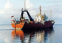
| Farnella 230 feet
|
 |
|
| Itinerary |
| Start |
Redwood City, CA |
1990-06-19 |
| End |
Redwood City, CA |
1990-07-14 |
|
| Bounds |
| West |
-125.27360335 |
| East |
-121.84909567 |
| North |
37.94782818 |
| South |
33.57384928 |
|